You are here: Home > Network List > UW - Pacific Northwest Regional Seismic Network Stations List
> Station LEBA Lebam, WA, USA > Earthquake Result Viewer
LEBA Lebam, WA, USA - Earthquake Result Viewer
*The percent match for this event was below the threshold and hence no stack was calculated.
| Earthquake location: |
Northeast Of Taiwan |
| Earthquake latitude/longitude: |
25.6/123.5 |
| Earthquake time(UTC): |
2016/02/02 (033) 14:19:22 GMT |
| Earthquake Depth: |
188 km |
| Earthquake Magnitude: |
5.8 MB, 5.7 MWB |
| Earthquake Catalog/Contributor: |
NEIC PDE/NEIC COMCAT |
|
| Network: |
UW Pacific Northwest Regional Seismic Network |
| Station: |
LEBA Lebam, WA, USA |
| Lat/Lon: |
46.55 N/123.56 W |
| Elevation: |
73 m |
|
| Distance: |
86.1 deg |
| Az: |
39.563 deg |
| Baz: |
303.555 deg |
| Ray Param: |
$rayparam |
*The percent match for this event was below the threshold and hence was not used in the summary stack. |
|
| Radial Match: |
55.50415 % |
| Radial Bump: |
400 |
| Transverse Match: |
45.75602 % |
| Transverse Bump: |
400 |
| SOD ConfigId: |
7422571 |
| Insert Time: |
2019-04-21 21:24:40.114 +0000 |
| GWidth: |
2.5 |
| Max Bumps: |
400 |
| Tol: |
0.001 |
|
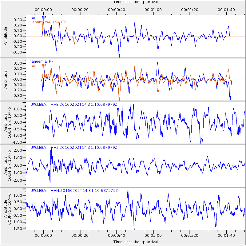
Signal To Noise
| Channel | StoN | STA | LTA |
| UW:LEBA: :HHZ:20160202T14:31:10.687979Z | 2.0495307 | 9.4624437E-7 | 4.616883E-7 |
| UW:LEBA: :HHN:20160202T14:31:10.687979Z | 0.8632461 | 3.895237E-7 | 4.512314E-7 |
| UW:LEBA: :HHE:20160202T14:31:10.687979Z | 1.2833357 | 5.0012557E-7 | 3.8970754E-7 |
| Arrivals |
| Ps | |
| PpPs | |
| PsPs/PpSs | |


