You are here: Home > Network List > TA - USArray Transportable Network (new EarthScope stations) Stations List
> Station G03D McMinnville, OR, USA > Earthquake Result Viewer
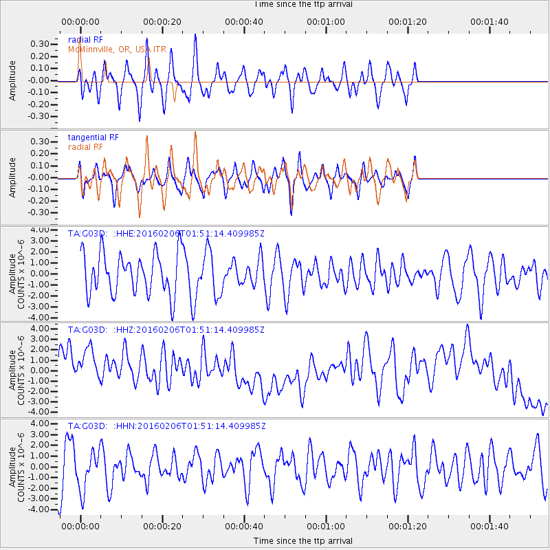
G03D McMinnville, OR, USA - Earthquake Result Viewer
*The percent match for this event was below the threshold and hence no stack was calculated.
| Earthquake location: |
Fiji Islands Region |
| Earthquake latitude/longitude: |
-17.0/174.9 |
| Earthquake time(UTC): |
2016/02/06 (037) 01:39:18 GMT |
| Earthquake Depth: |
10 km |
| Earthquake Magnitude: |
5.5 MB |
| Earthquake Catalog/Contributor: |
NEIC PDE/NEIC COMCAT |
|
| Network: |
TA USArray Transportable Network (new EarthScope stations) |
| Station: |
G03D McMinnville, OR, USA |
| Lat/Lon: |
45.21 N/123.26 W |
| Elevation: |
222 m |
|
| Distance: |
83.4 deg |
| Az: |
38.83 deg |
| Baz: |
238.075 deg |
| Ray Param: |
$rayparam |
*The percent match for this event was below the threshold and hence was not used in the summary stack. |
|
| Radial Match: |
68.22489 % |
| Radial Bump: |
400 |
| Transverse Match: |
46.032803 % |
| Transverse Bump: |
400 |
| SOD ConfigId: |
7422571 |
| Insert Time: |
2019-04-21 21:36:38.202 +0000 |
| GWidth: |
2.5 |
| Max Bumps: |
400 |
| Tol: |
0.001 |
|
Signal To Noise
| Channel | StoN | STA | LTA |
| TA:G03D: :HHZ:20160206T01:51:14.409985Z | 1.44092 | 3.8345074E-6 | 2.6611522E-6 |
| TA:G03D: :HHN:20160206T01:51:14.409985Z | 1.0523684 | 1.8093548E-6 | 1.719317E-6 |
| TA:G03D: :HHE:20160206T01:51:14.409985Z | 1.0677717 | 1.9657675E-6 | 1.8409999E-6 |
| Arrivals |
| Ps | |
| PpPs | |
| PsPs/PpSs | |


