You are here: Home > Network List > GS - US Geological Survey Networks Stations List
> Station DEC05 Decatur Surface Seismic Site, Decatur, IL, USA > Earthquake Result Viewer
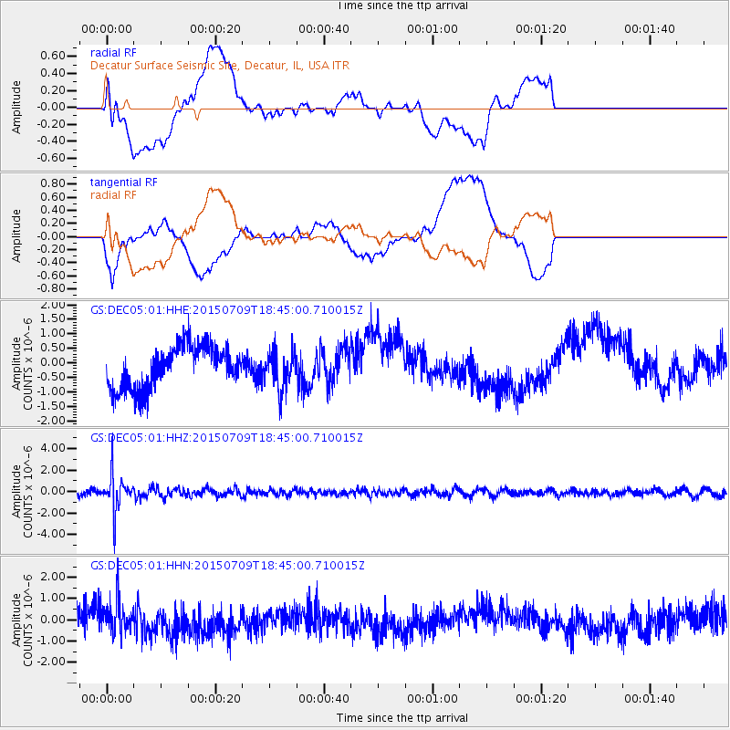
DEC05 Decatur Surface Seismic Site, Decatur, IL, USA - Earthquake Result Viewer
*The percent match for this event was below the threshold and hence no stack was calculated.
| Earthquake location: |
Near East Coast Of Honshu, Japan |
| Earthquake latitude/longitude: |
40.4/141.5 |
| Earthquake time(UTC): |
2015/07/09 (190) 18:32:51 GMT |
| Earthquake Depth: |
79 km |
| Earthquake Magnitude: |
5.6 MWB, 5.5 MWW, 5.6 MWR, 5.6 MWC |
| Earthquake Catalog/Contributor: |
NEIC PDE/NEIC COMCAT |
|
| Network: |
GS US Geological Survey Networks |
| Station: |
DEC05 Decatur Surface Seismic Site, Decatur, IL, USA |
| Lat/Lon: |
39.87 N/88.87 W |
| Elevation: |
216 m |
|
| Distance: |
87.9 deg |
| Az: |
36.365 deg |
| Baz: |
323.938 deg |
| Ray Param: |
$rayparam |
*The percent match for this event was below the threshold and hence was not used in the summary stack. |
|
| Radial Match: |
30.21588 % |
| Radial Bump: |
400 |
| Transverse Match: |
28.675512 % |
| Transverse Bump: |
400 |
| SOD ConfigId: |
1080791 |
| Insert Time: |
2015-07-23 20:32:35.755 +0000 |
| GWidth: |
2.5 |
| Max Bumps: |
400 |
| Tol: |
0.001 |
|
Signal To Noise
| Channel | StoN | STA | LTA |
| GS:DEC05:01:HHZ:20150709T18:45:00.710015Z | 5.8448973 | 1.668446E-6 | 2.854534E-7 |
| GS:DEC05:01:HHN:20150709T18:45:00.710015Z | 1.4274247 | 8.6550983E-7 | 6.063436E-7 |
| GS:DEC05:01:HHE:20150709T18:45:00.710015Z | 0.89459735 | 6.461202E-7 | 7.2224697E-7 |
| Arrivals |
| Ps | |
| PpPs | |
| PsPs/PpSs | |


