You are here: Home > Network List > CI - Caltech Regional Seismic Network Stations List
> Station SMM Simmler, CA, USA > Earthquake Result Viewer
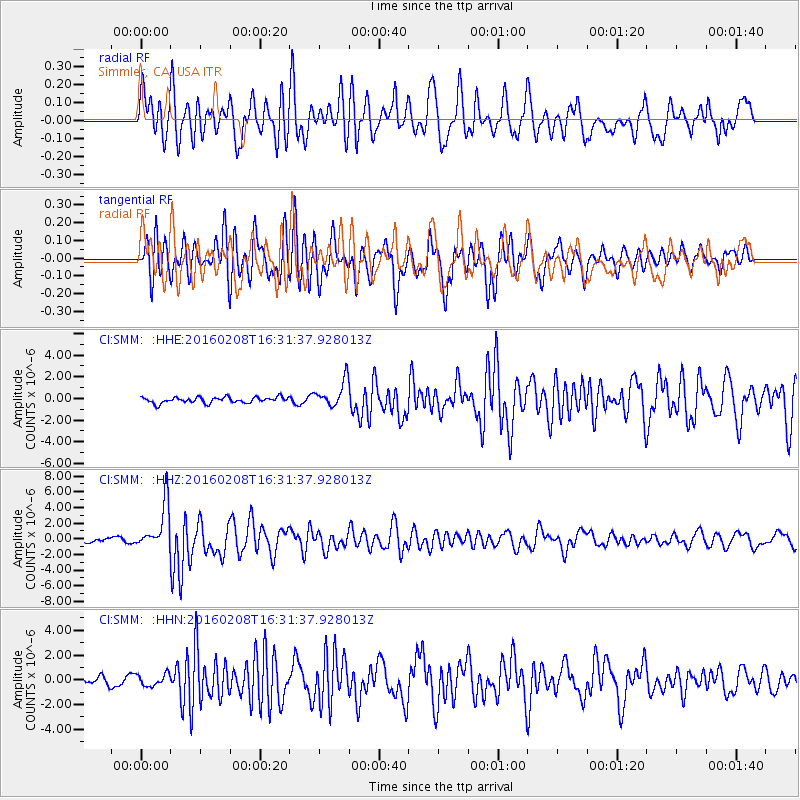
SMM Simmler, CA, USA - Earthquake Result Viewer
*The percent match for this event was below the threshold and hence no stack was calculated.
| Earthquake location: |
Solomon Islands |
| Earthquake latitude/longitude: |
-6.6/154.7 |
| Earthquake time(UTC): |
2016/02/08 (039) 16:19:13 GMT |
| Earthquake Depth: |
32 km |
| Earthquake Magnitude: |
6.4 MWW, 6.3 MWB, 6.7 MI |
| Earthquake Catalog/Contributor: |
NEIC PDE/NEIC COMCAT |
|
| Network: |
CI Caltech Regional Seismic Network |
| Station: |
SMM Simmler, CA, USA |
| Lat/Lon: |
35.31 N/120.00 W |
| Elevation: |
599 m |
|
| Distance: |
90.0 deg |
| Az: |
54.594 deg |
| Baz: |
261.92 deg |
| Ray Param: |
$rayparam |
*The percent match for this event was below the threshold and hence was not used in the summary stack. |
|
| Radial Match: |
74.102264 % |
| Radial Bump: |
400 |
| Transverse Match: |
80.26785 % |
| Transverse Bump: |
400 |
| SOD ConfigId: |
7422571 |
| Insert Time: |
2019-04-21 21:49:14.404 +0000 |
| GWidth: |
2.5 |
| Max Bumps: |
400 |
| Tol: |
0.001 |
|
Signal To Noise
| Channel | StoN | STA | LTA |
| CI:SMM: :HHZ:20160208T16:31:37.928013Z | 6.572369 | 2.9178714E-6 | 4.4396035E-7 |
| CI:SMM: :HHN:20160208T16:31:37.928013Z | 1.5740913 | 4.8232687E-7 | 3.0641607E-7 |
| CI:SMM: :HHE:20160208T16:31:37.928013Z | 4.6242557 | 1.2204368E-6 | 2.639207E-7 |
| Arrivals |
| Ps | |
| PpPs | |
| PsPs/PpSs | |


