You are here: Home > Network List > TA - USArray Transportable Network (new EarthScope stations) Stations List
> Station L19K White Mountain, AK, USA > Earthquake Result Viewer
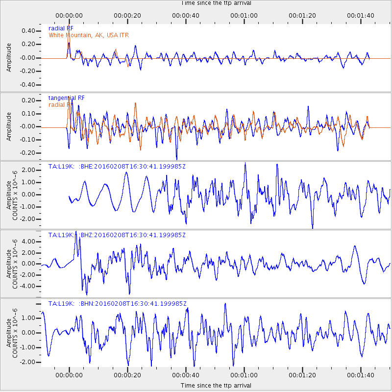
L19K White Mountain, AK, USA - Earthquake Result Viewer
*The percent match for this event was below the threshold and hence no stack was calculated.
| Earthquake location: |
Solomon Islands |
| Earthquake latitude/longitude: |
-6.6/154.7 |
| Earthquake time(UTC): |
2016/02/08 (039) 16:19:13 GMT |
| Earthquake Depth: |
32 km |
| Earthquake Magnitude: |
6.4 MWW, 6.3 MWB, 6.7 MI |
| Earthquake Catalog/Contributor: |
NEIC PDE/NEIC COMCAT |
|
| Network: |
TA USArray Transportable Network (new EarthScope stations) |
| Station: |
L19K White Mountain, AK, USA |
| Lat/Lon: |
62.18 N/154.85 W |
| Elevation: |
650 m |
|
| Distance: |
78.7 deg |
| Az: |
21.641 deg |
| Baz: |
231.349 deg |
| Ray Param: |
$rayparam |
*The percent match for this event was below the threshold and hence was not used in the summary stack. |
|
| Radial Match: |
61.868233 % |
| Radial Bump: |
400 |
| Transverse Match: |
64.303696 % |
| Transverse Bump: |
400 |
| SOD ConfigId: |
7422571 |
| Insert Time: |
2019-04-21 21:52:21.522 +0000 |
| GWidth: |
2.5 |
| Max Bumps: |
400 |
| Tol: |
0.001 |
|
Signal To Noise
| Channel | StoN | STA | LTA |
| TA:L19K: :BHZ:20160208T16:30:41.199985Z | 4.5822244 | 2.7041629E-6 | 5.9014195E-7 |
| TA:L19K: :BHN:20160208T16:30:41.199985Z | 0.8475502 | 6.2118414E-7 | 7.329172E-7 |
| TA:L19K: :BHE:20160208T16:30:41.199985Z | 1.0880347 | 8.5723434E-7 | 7.8787406E-7 |
| Arrivals |
| Ps | |
| PpPs | |
| PsPs/PpSs | |


