WMQ Urumqi, Xinjiang Province, China - Earthquake Result Viewer
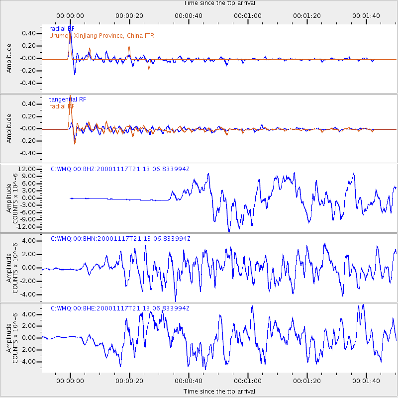
Earthquake location: New Britain Region, P.N.G.
Earthquake latitude/longitude: -5.5/151.8
Earthquake time(UTC): 2000/11/17 (322) 21:01:56 GMT
Earthquake Depth: 33 km
Earthquake Magnitude: 6.2 MB, 8.0 MS, 7.6 MW, 6.9 ME
Earthquake Catalog/Contributor: WHDF/NEIC
Network: IC New China Digital Seismograph Network
Station: WMQ Urumqi, Xinjiang Province, China
Lat/Lon: 43.82 N/87.69 E
Elevation: 903 m
Distance: 75.6 deg
Az: 317.758 deg
Baz: 112.399 deg
Ray Param: 0.051534425
Estimated Moho Depth: 21.0 km
Estimated Crust Vp/Vs: 1.73
Assumed Crust Vp: 6.242 km/s
Estimated Crust Vs: 3.608 km/s
Estimated Crust Poisson's Ratio: 0.25
Radial Match: 96.776955 %
Radial Bump: 400
Transverse Match: 86.77046 %
Transverse Bump: 400
SOD ConfigId: 3744
Insert Time: 2010-03-04 23:55:54.574 +0000
GWidth: 2.5
Max Bumps: 400
Tol: 0.001

Signal To Noise

ChannelStoNSTALTA
IC:WMQ:00:BHN:20001117T21:13:06.833994Z3.31855632.313243E-76.97063E-8
IC:WMQ:00:BHE:20001117T21:13:06.833994Z3.27084733.9910591E-71.2201913E-7
IC:WMQ:00:BHZ:20001117T21:13:06.833994Z5.1073431.0560473E-62.0677038E-7
Arrivals
Ps2.5 SECOND
PpPs8.9 SECOND
PsPs/PpSs11 SECOND