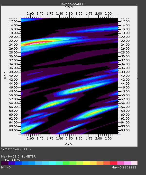
WMQ Urumqi, Xinjiang Province, China - Earthquake Result Viewer

Earthquake location: Southwest Of Sumatra, Indonesia
Earthquake latitude/longitude: -5.4/101.8
Earthquake time(UTC): 2000/09/12 (256) 16:27:24 GMT
Earthquake Depth: 33 km
Earthquake Magnitude: 5.7 MB, 6.1 MS, 6.0 MW, 5.9 MW
Earthquake Catalog/Contributor: WHDF/NEIC
Network: IC New China Digital Seismograph Network
Station: WMQ Urumqi, Xinjiang Province, China
Lat/Lon: 43.82 N/87.69 E
Elevation: 903 m
Distance: 50.7 deg
Az: 346.795 deg
Baz: 161.688 deg
Ray Param: 0.06784055
Estimated Moho Depth: 23.0 km
Estimated Crust Vp/Vs: 1.69
Assumed Crust Vp: 6.242 km/s
Estimated Crust Vs: 3.699 km/s
Estimated Crust Poisson's Ratio: 0.23
Radial Match: 95.04139 %
Radial Bump: 400
Transverse Match: 88.340836 %
Transverse Bump: 400
SOD ConfigId: 3744
Insert Time: 2010-03-04 23:56:06.437 +0000
GWidth: 2.5
Max Bumps: 400
Tol: 0.001

Signal To Noise

ChannelStoNSTALTA
IC:WMQ:00:BHN:20000912T16:35:50.085005Z1.81195341.4856938E-78.199404E-8
IC:WMQ:00:BHE:20000912T16:35:50.085005Z1.58491171.2342105E-77.787251E-8
IC:WMQ:00:BHZ:20000912T16:35:50.085005Z6.35543164.6017416E-77.2406436E-8
Arrivals
Ps2.7 SECOND
PpPs9.4 SECOND
PsPs/PpSs12 SECOND