WMQ Urumqi, Xinjiang Province, China - Earthquake Result Viewer
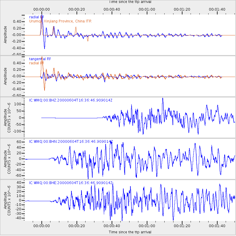
Earthquake location: Southern Sumatra, Indonesia
Earthquake latitude/longitude: -4.7/102.1
Earthquake time(UTC): 2000/06/04 (156) 16:28:26 GMT
Earthquake Depth: 33 km
Earthquake Magnitude: 6.8 MB, 8.0 MS, 7.9 MW, 7.7 MW
Earthquake Catalog/Contributor: WHDF/NEIC
Network: IC New China Digital Seismograph Network
Station: WMQ Urumqi, Xinjiang Province, China
Lat/Lon: 43.82 N/87.69 E
Elevation: 903 m
Distance: 50.0 deg
Az: 346.423 deg
Baz: 161.142 deg
Ray Param: 0.06826046
Estimated Moho Depth: 45.5 km
Estimated Crust Vp/Vs: 1.92
Assumed Crust Vp: 6.242 km/s
Estimated Crust Vs: 3.243 km/s
Estimated Crust Poisson's Ratio: 0.32
Radial Match: 94.778465 %
Radial Bump: 400
Transverse Match: 92.41284 %
Transverse Bump: 400
SOD ConfigId: 3744
Insert Time: 2010-03-04 23:56:33.684 +0000
GWidth: 2.5
Max Bumps: 400
Tol: 0.001

Signal To Noise

ChannelStoNSTALTA
IC:WMQ:00:BHN:20000604T16:36:46.909014Z1.47061233.9223028E-72.6671222E-7
IC:WMQ:00:BHE:20000604T16:36:46.909014Z0.998294231.31503E-71.317277E-7
IC:WMQ:00:BHZ:20000604T16:36:46.909014Z1.28530876.676282E-75.194302E-7
Arrivals
Ps7.1 SECOND
PpPs20 SECOND
PsPs/PpSs27 SECOND