WMQ Urumqi, Xinjiang Province, China - Earthquake Result Viewer
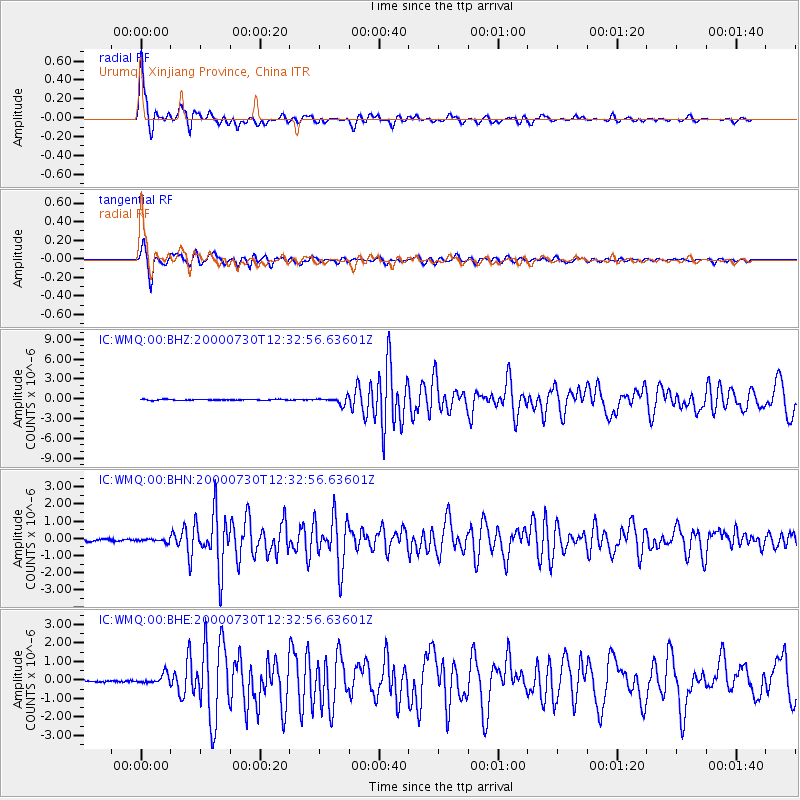
Earthquake location: Southeast Of Honshu, Japan
Earthquake latitude/longitude: 33.9/139.4
Earthquake time(UTC): 2000/07/30 (212) 12:25:45 GMT
Earthquake Depth: 10 km
Earthquake Magnitude: 6.0 MB, 6.5 MS, 6.5 MW, 6.5 MW
Earthquake Catalog/Contributor: WHDF/NEIC
Network: IC New China Digital Seismograph Network
Station: WMQ Urumqi, Xinjiang Province, China
Lat/Lon: 43.82 N/87.69 E
Elevation: 903 m
Distance: 40.9 deg
Az: 299.761 deg
Baz: 85.966 deg
Ray Param: 0.07415256
Estimated Moho Depth: 25.0 km
Estimated Crust Vp/Vs: 2.09
Assumed Crust Vp: 6.242 km/s
Estimated Crust Vs: 2.983 km/s
Estimated Crust Poisson's Ratio: 0.35
Radial Match: 95.31761 %
Radial Bump: 400
Transverse Match: 89.06083 %
Transverse Bump: 400
SOD ConfigId: 3744
Insert Time: 2010-03-04 23:57:05.135 +0000
GWidth: 2.5
Max Bumps: 400
Tol: 0.001

Signal To Noise

ChannelStoNSTALTA
IC:WMQ:00:BHN:20000730T12:32:56.63601Z1.37753949.257242E-86.720129E-8
IC:WMQ:00:BHE:20000730T12:32:56.63601Z6.07734732.603367E-74.2837225E-8
IC:WMQ:00:BHZ:20000730T12:32:56.63601Z6.93574575.072013E-77.312859E-8
Arrivals
Ps4.6 SECOND
PpPs12 SECOND
PsPs/PpSs16 SECOND