
WMQ Urumqi, Xinjiang Province, China - Earthquake Result Viewer
| ||||||||||||||||||
| ||||||||||||||||||
| ||||||||||||||||||
|
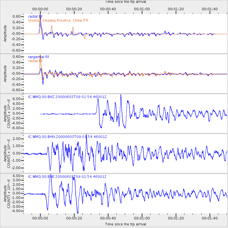
Signal To Noise
| Channel | StoN | STA | LTA |
| IC:WMQ:00:BHN:20000603T09:01:54.46001Z | 6.323957 | 2.8720922E-7 | 4.5416062E-8 |
| IC:WMQ:00:BHE:20000603T09:01:54.46001Z | 27.436369 | 1.3694769E-6 | 4.9914657E-8 |
| IC:WMQ:00:BHZ:20000603T09:01:54.46001Z | 33.554554 | 2.3403077E-6 | 6.974635E-8 |
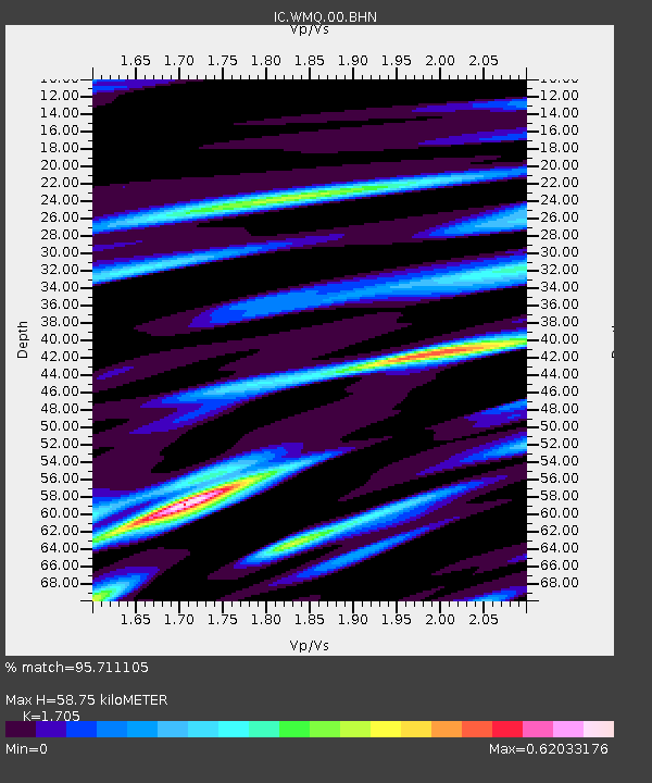
| Arrivals | |
| Ps | 7.1 SECOND |
| PpPs | 24 SECOND |
| PsPs/PpSs | 31 SECOND |

