You are here: Home > Network List > TA - USArray Transportable Network (new EarthScope stations) Stations List
> Station A04D Lummi Island, WA, USA > Earthquake Result Viewer
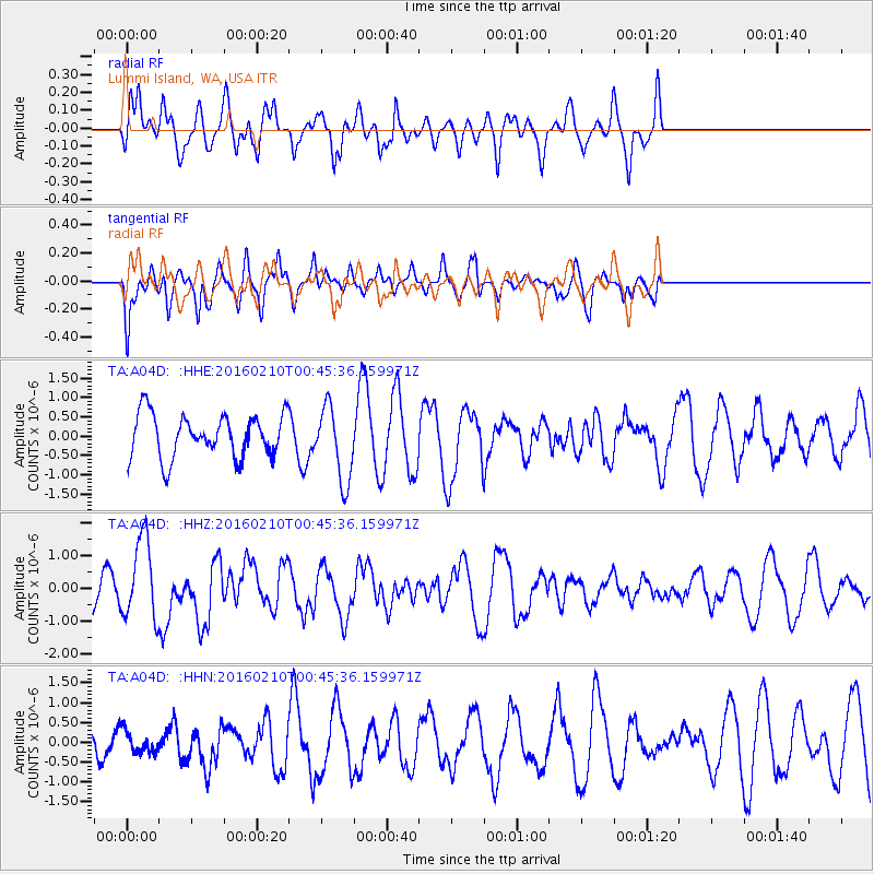
A04D Lummi Island, WA, USA - Earthquake Result Viewer
*The percent match for this event was below the threshold and hence no stack was calculated.
| Earthquake location: |
Near Coast Of Central Chile |
| Earthquake latitude/longitude: |
-30.6/-71.6 |
| Earthquake time(UTC): |
2016/02/10 (041) 00:33:05 GMT |
| Earthquake Depth: |
32 km |
| Earthquake Magnitude: |
6.3 MWB |
| Earthquake Catalog/Contributor: |
NEIC PDE/NEIC COMCAT |
|
| Network: |
TA USArray Transportable Network (new EarthScope stations) |
| Station: |
A04D Lummi Island, WA, USA |
| Lat/Lon: |
48.72 N/122.71 W |
| Elevation: |
13 m |
|
| Distance: |
91.2 deg |
| Az: |
328.976 deg |
| Baz: |
137.87 deg |
| Ray Param: |
$rayparam |
*The percent match for this event was below the threshold and hence was not used in the summary stack. |
|
| Radial Match: |
66.32941 % |
| Radial Bump: |
391 |
| Transverse Match: |
63.74344 % |
| Transverse Bump: |
381 |
| SOD ConfigId: |
7422571 |
| Insert Time: |
2019-04-21 22:04:50.670 +0000 |
| GWidth: |
2.5 |
| Max Bumps: |
400 |
| Tol: |
0.001 |
|
Signal To Noise
| Channel | StoN | STA | LTA |
| TA:A04D: :HHZ:20160210T00:45:36.159971Z | 3.036606 | 1.2408656E-6 | 4.0863569E-7 |
| TA:A04D: :HHN:20160210T00:45:36.159971Z | 0.6531581 | 2.5947546E-7 | 3.9726282E-7 |
| TA:A04D: :HHE:20160210T00:45:36.159971Z | 1.7534412 | 9.753087E-7 | 5.562255E-7 |
| Arrivals |
| Ps | |
| PpPs | |
| PsPs/PpSs | |


