You are here: Home > Network List > TA - USArray Transportable Network (new EarthScope stations) Stations List
> Station KSCO Kaye Shedlock's, Cheyenne Wells, CO, USA > Earthquake Result Viewer
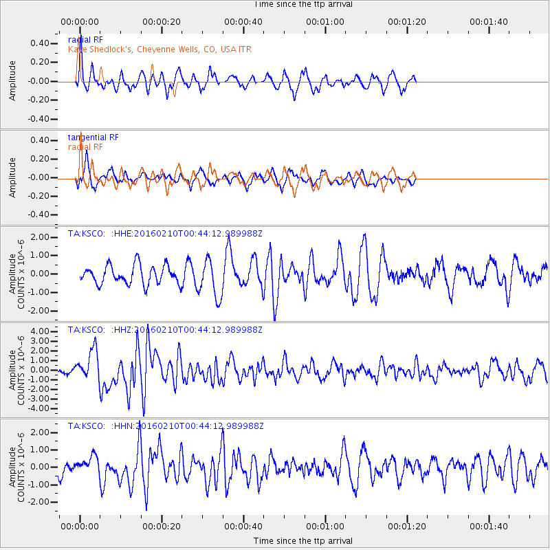
KSCO Kaye Shedlock's, Cheyenne Wells, CO, USA - Earthquake Result Viewer
*The percent match for this event was below the threshold and hence no stack was calculated.
| Earthquake location: |
Near Coast Of Central Chile |
| Earthquake latitude/longitude: |
-30.6/-71.6 |
| Earthquake time(UTC): |
2016/02/10 (041) 00:33:05 GMT |
| Earthquake Depth: |
32 km |
| Earthquake Magnitude: |
6.3 MWB |
| Earthquake Catalog/Contributor: |
NEIC PDE/NEIC COMCAT |
|
| Network: |
TA USArray Transportable Network (new EarthScope stations) |
| Station: |
KSCO Kaye Shedlock's, Cheyenne Wells, CO, USA |
| Lat/Lon: |
39.01 N/102.63 W |
| Elevation: |
1382 m |
|
| Distance: |
75.1 deg |
| Az: |
335.457 deg |
| Baz: |
152.642 deg |
| Ray Param: |
$rayparam |
*The percent match for this event was below the threshold and hence was not used in the summary stack. |
|
| Radial Match: |
76.75753 % |
| Radial Bump: |
358 |
| Transverse Match: |
48.98593 % |
| Transverse Bump: |
320 |
| SOD ConfigId: |
7422571 |
| Insert Time: |
2019-04-21 22:05:04.415 +0000 |
| GWidth: |
2.5 |
| Max Bumps: |
400 |
| Tol: |
0.001 |
|
Signal To Noise
| Channel | StoN | STA | LTA |
| TA:KSCO: :HHZ:20160210T00:44:12.989988Z | 7.9041743 | 1.6282166E-6 | 2.0599452E-7 |
| TA:KSCO: :HHN:20160210T00:44:12.989988Z | 0.92321986 | 5.257966E-7 | 5.6952484E-7 |
| TA:KSCO: :HHE:20160210T00:44:12.989988Z | 2.017375 | 1.0194905E-6 | 5.05355E-7 |
| Arrivals |
| Ps | |
| PpPs | |
| PsPs/PpSs | |


