You are here: Home > Network List > TA - USArray Transportable Network (new EarthScope stations) Stations List
> Station R11A Troy Canyon, Currant, NV, USA > Earthquake Result Viewer
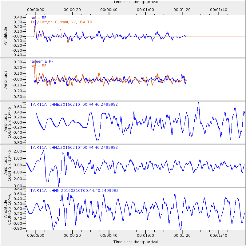
R11A Troy Canyon, Currant, NV, USA - Earthquake Result Viewer
*The percent match for this event was below the threshold and hence no stack was calculated.
| Earthquake location: |
Near Coast Of Central Chile |
| Earthquake latitude/longitude: |
-30.6/-71.6 |
| Earthquake time(UTC): |
2016/02/10 (041) 00:33:05 GMT |
| Earthquake Depth: |
32 km |
| Earthquake Magnitude: |
6.3 MWB |
| Earthquake Catalog/Contributor: |
NEIC PDE/NEIC COMCAT |
|
| Network: |
TA USArray Transportable Network (new EarthScope stations) |
| Station: |
R11A Troy Canyon, Currant, NV, USA |
| Lat/Lon: |
38.35 N/115.59 W |
| Elevation: |
1756 m |
|
| Distance: |
79.9 deg |
| Az: |
326.334 deg |
| Baz: |
142.576 deg |
| Ray Param: |
$rayparam |
*The percent match for this event was below the threshold and hence was not used in the summary stack. |
|
| Radial Match: |
76.32814 % |
| Radial Bump: |
350 |
| Transverse Match: |
52.1477 % |
| Transverse Bump: |
400 |
| SOD ConfigId: |
7422571 |
| Insert Time: |
2019-04-21 22:05:22.632 +0000 |
| GWidth: |
2.5 |
| Max Bumps: |
400 |
| Tol: |
0.001 |
|
Signal To Noise
| Channel | StoN | STA | LTA |
| TA:R11A: :HHZ:20160210T00:44:40.249998Z | 4.1586747 | 1.1910291E-6 | 2.863963E-7 |
| TA:R11A: :HHN:20160210T00:44:40.249998Z | 0.74684113 | 1.7238156E-7 | 2.3081422E-7 |
| TA:R11A: :HHE:20160210T00:44:40.249998Z | 3.5146682 | 4.6526623E-7 | 1.3237842E-7 |
| Arrivals |
| Ps | |
| PpPs | |
| PsPs/PpSs | |


