You are here: Home > Network List > TA - USArray Transportable Network (new EarthScope stations) Stations List
> Station X43A Marvell, AR, USA > Earthquake Result Viewer
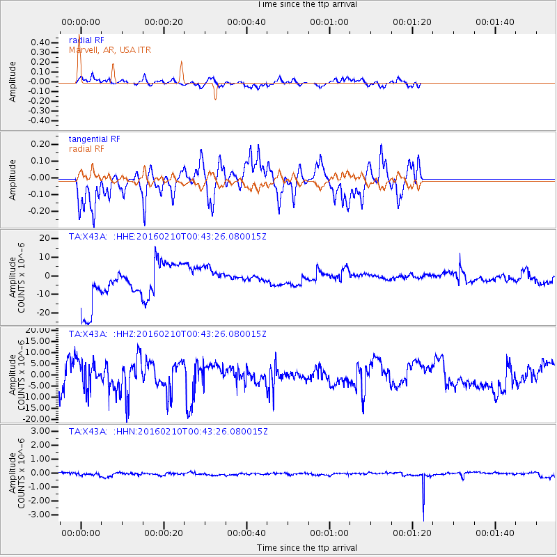
X43A Marvell, AR, USA - Earthquake Result Viewer
*The percent match for this event was below the threshold and hence no stack was calculated.
| Earthquake location: |
Near Coast Of Central Chile |
| Earthquake latitude/longitude: |
-30.6/-71.6 |
| Earthquake time(UTC): |
2016/02/10 (041) 00:33:05 GMT |
| Earthquake Depth: |
32 km |
| Earthquake Magnitude: |
6.3 MWB |
| Earthquake Catalog/Contributor: |
NEIC PDE/NEIC COMCAT |
|
| Network: |
TA USArray Transportable Network (new EarthScope stations) |
| Station: |
X43A Marvell, AR, USA |
| Lat/Lon: |
34.52 N/90.88 W |
| Elevation: |
53 m |
|
| Distance: |
67.3 deg |
| Az: |
342.827 deg |
| Baz: |
162.049 deg |
| Ray Param: |
$rayparam |
*The percent match for this event was below the threshold and hence was not used in the summary stack. |
|
| Radial Match: |
60.14514 % |
| Radial Bump: |
332 |
| Transverse Match: |
61.22976 % |
| Transverse Bump: |
345 |
| SOD ConfigId: |
7422571 |
| Insert Time: |
2019-04-21 22:05:30.292 +0000 |
| GWidth: |
2.5 |
| Max Bumps: |
400 |
| Tol: |
0.001 |
|
Signal To Noise
| Channel | StoN | STA | LTA |
| TA:X43A: :HHZ:20160210T00:43:26.080015Z | 0.87449616 | 5.4735674E-6 | 6.25911E-6 |
| TA:X43A: :HHN:20160210T00:43:26.080015Z | 1.0969468 | 7.669088E-8 | 6.991303E-8 |
| TA:X43A: :HHE:20160210T00:43:26.080015Z | 0.6996081 | 6.8275863E-6 | 9.759158E-6 |
| Arrivals |
| Ps | |
| PpPs | |
| PsPs/PpSs | |


