You are here: Home > Network List > TA - USArray Transportable Network (new EarthScope stations) Stations List
> Station Z41A Richland Creek Farm, El Dorado, AR, USA > Earthquake Result Viewer
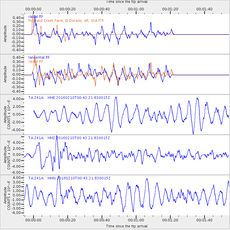
Z41A Richland Creek Farm, El Dorado, AR, USA - Earthquake Result Viewer
*The percent match for this event was below the threshold and hence no stack was calculated.
| Earthquake location: |
Near Coast Of Central Chile |
| Earthquake latitude/longitude: |
-30.6/-71.6 |
| Earthquake time(UTC): |
2016/02/10 (041) 00:33:05 GMT |
| Earthquake Depth: |
32 km |
| Earthquake Magnitude: |
6.3 MWB |
| Earthquake Catalog/Contributor: |
NEIC PDE/NEIC COMCAT |
|
| Network: |
TA USArray Transportable Network (new EarthScope stations) |
| Station: |
Z41A Richland Creek Farm, El Dorado, AR, USA |
| Lat/Lon: |
33.26 N/92.80 W |
| Elevation: |
62 m |
|
| Distance: |
66.6 deg |
| Az: |
340.741 deg |
| Baz: |
160.166 deg |
| Ray Param: |
$rayparam |
*The percent match for this event was below the threshold and hence was not used in the summary stack. |
|
| Radial Match: |
60.042404 % |
| Radial Bump: |
335 |
| Transverse Match: |
69.53211 % |
| Transverse Bump: |
366 |
| SOD ConfigId: |
7422571 |
| Insert Time: |
2019-04-21 22:05:31.046 +0000 |
| GWidth: |
2.5 |
| Max Bumps: |
400 |
| Tol: |
0.001 |
|
Signal To Noise
| Channel | StoN | STA | LTA |
| TA:Z41A: :HHZ:20160210T00:43:21.830015Z | 4.5127416 | 2.5463903E-6 | 5.6426677E-7 |
| TA:Z41A: :HHN:20160210T00:43:21.830015Z | 1.0370959 | 1.2101832E-6 | 1.1668961E-6 |
| TA:Z41A: :HHE:20160210T00:43:21.830015Z | 1.3577102 | 1.3803359E-6 | 1.0166646E-6 |
| Arrivals |
| Ps | |
| PpPs | |
| PsPs/PpSs | |


