You are here: Home > Network List > UW - Pacific Northwest Regional Seismic Network Stations List
> Station PASS Maple Falls, WA, USA > Earthquake Result Viewer
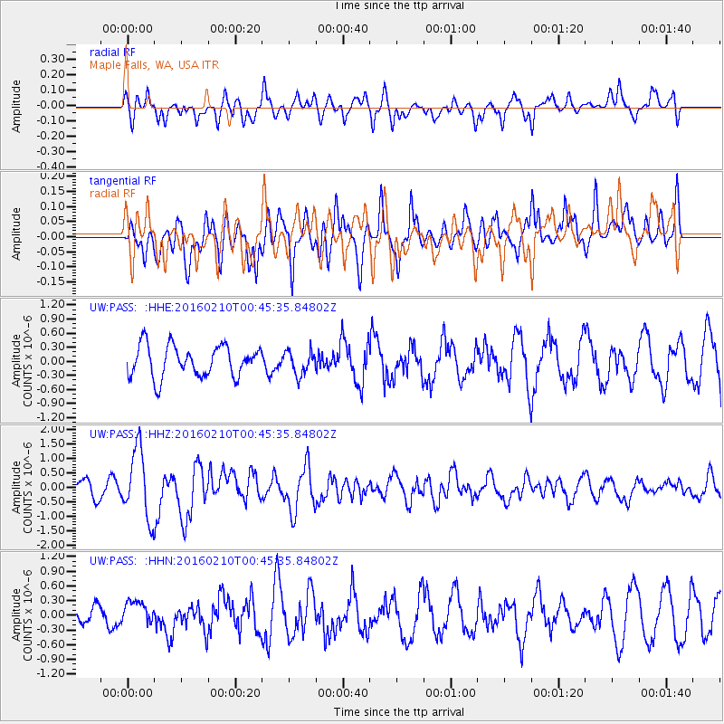
PASS Maple Falls, WA, USA - Earthquake Result Viewer
*The percent match for this event was below the threshold and hence no stack was calculated.
| Earthquake location: |
Near Coast Of Central Chile |
| Earthquake latitude/longitude: |
-30.6/-71.6 |
| Earthquake time(UTC): |
2016/02/10 (041) 00:33:05 GMT |
| Earthquake Depth: |
32 km |
| Earthquake Magnitude: |
6.3 MWB |
| Earthquake Catalog/Contributor: |
NEIC PDE/NEIC COMCAT |
|
| Network: |
UW Pacific Northwest Regional Seismic Network |
| Station: |
PASS Maple Falls, WA, USA |
| Lat/Lon: |
49.00 N/122.09 W |
| Elevation: |
174 m |
|
| Distance: |
91.2 deg |
| Az: |
329.467 deg |
| Baz: |
138.326 deg |
| Ray Param: |
$rayparam |
*The percent match for this event was below the threshold and hence was not used in the summary stack. |
|
| Radial Match: |
70.644485 % |
| Radial Bump: |
400 |
| Transverse Match: |
55.137383 % |
| Transverse Bump: |
400 |
| SOD ConfigId: |
7422571 |
| Insert Time: |
2019-04-21 22:06:12.066 +0000 |
| GWidth: |
2.5 |
| Max Bumps: |
400 |
| Tol: |
0.001 |
|
Signal To Noise
| Channel | StoN | STA | LTA |
| UW:PASS: :HHZ:20160210T00:45:35.84802Z | 4.1928735 | 1.2102485E-6 | 2.8864417E-7 |
| UW:PASS: :HHN:20160210T00:45:35.84802Z | 0.7492461 | 2.3988522E-7 | 3.201688E-7 |
| UW:PASS: :HHE:20160210T00:45:35.84802Z | 0.77903175 | 2.578979E-7 | 3.3104928E-7 |
| Arrivals |
| Ps | |
| PpPs | |
| PsPs/PpSs | |


