WMQ Urumqi, Xinjiang Province, China - Earthquake Result Viewer
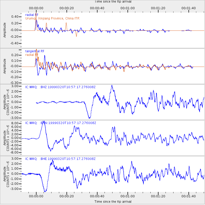
Earthquake location: Andreanof Islands, Aleutian Is.
Earthquake latitude/longitude: 51.6/-177.7
Earthquake time(UTC): 1999/03/20 (079) 10:47:45 GMT
Earthquake Depth: 33 km
Earthquake Magnitude: 6.3 MB, 6.8 MS, 6.9 MW, 6.8 ME
Earthquake Catalog/Contributor: WHDF/NEIC
Network: IC New China Digital Seismograph Network
Station: WMQ Urumqi, Xinjiang Province, China
Lat/Lon: 43.82 N/87.69 E
Elevation: 903 m
Distance: 59.8 deg
Az: 303.427 deg
Baz: 46.001 deg
Ray Param: 0.06188143
Estimated Moho Depth: 10.0 km
Estimated Crust Vp/Vs: 1.87
Assumed Crust Vp: 6.242 km/s
Estimated Crust Vs: 3.338 km/s
Estimated Crust Poisson's Ratio: 0.30
Radial Match: 96.41148 %
Radial Bump: 385
Transverse Match: 87.65082 %
Transverse Bump: 400
SOD ConfigId: 4480
Insert Time: 2010-03-04 23:59:09.956 +0000
GWidth: 2.5
Max Bumps: 400
Tol: 0.001

Signal To Noise

ChannelStoNSTALTA
IC:WMQ: :BHN:19990320T10:57:17.276008Z42.739764.306575E-61.0076273E-7
IC:WMQ: :BHE:19990320T10:57:17.276008Z8.8942899.898798E-71.11293865E-7
IC:WMQ: :BHZ:19990320T10:57:17.276008Z14.6627221.3457395E-69.1779654E-8
Arrivals
Ps1.5 SECOND
PpPs4.4 SECOND
PsPs/PpSs5.9 SECOND