
WMQ Urumqi, Xinjiang Province, China - Earthquake Result Viewer
| ||||||||||||||||||
| ||||||||||||||||||
| ||||||||||||||||||
|
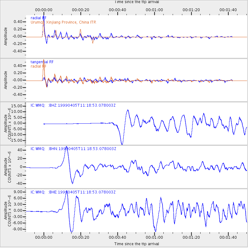
Signal To Noise
| Channel | StoN | STA | LTA |
| IC:WMQ: :BHN:19990405T11:18:53.078003Z | 2.7818453 | 9.1433805E-7 | 3.2868041E-7 |
| IC:WMQ: :BHE:19990405T11:18:53.078003Z | 2.1332588 | 2.159185E-7 | 1.01215335E-7 |
| IC:WMQ: :BHZ:19990405T11:18:53.078003Z | 3.5879312 | 4.7291832E-7 | 1.3180808E-7 |
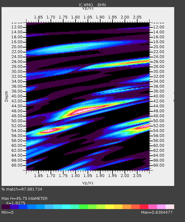
| Arrivals | |
| Ps | 6.2 SECOND |
| PpPs | 20 SECOND |
| PsPs/PpSs | 26 SECOND |

