You are here: Home > Network List > KN - Kyrgyz Seismic Telemetry Network Stations List
> Station TKM2 - > Earthquake Result Viewer
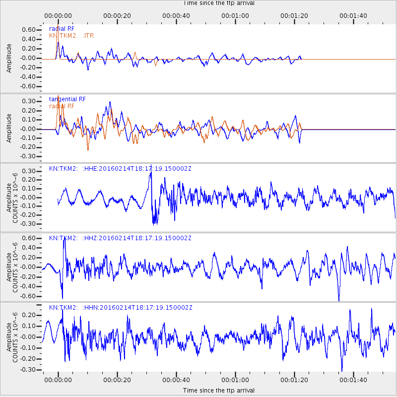
TKM2 - - Earthquake Result Viewer
*The percent match for this event was below the threshold and hence no stack was calculated.
| Earthquake location: |
Southeast Of Honshu, Japan |
| Earthquake latitude/longitude: |
30.3/138.9 |
| Earthquake time(UTC): |
2016/02/14 (045) 18:09:26 GMT |
| Earthquake Depth: |
413 km |
| Earthquake Magnitude: |
5.7 MB |
| Earthquake Catalog/Contributor: |
NEIC PDE/NEIC COMCAT |
|
| Network: |
KN Kyrgyz Seismic Telemetry Network |
| Station: |
TKM2 - |
| Lat/Lon: |
42.92 N/75.60 E |
| Elevation: |
2020 m |
|
| Distance: |
51.2 deg |
| Az: |
302.683 deg |
| Baz: |
82.281 deg |
| Ray Param: |
$rayparam |
*The percent match for this event was below the threshold and hence was not used in the summary stack. |
|
| Radial Match: |
70.07352 % |
| Radial Bump: |
362 |
| Transverse Match: |
48.30487 % |
| Transverse Bump: |
400 |
| SOD ConfigId: |
7422571 |
| Insert Time: |
2019-04-21 22:18:51.943 +0000 |
| GWidth: |
2.5 |
| Max Bumps: |
400 |
| Tol: |
0.001 |
|
Signal To Noise
| Channel | StoN | STA | LTA |
| KN:TKM2: :HHZ:20160214T18:17:19.150002Z | 3.9813871 | 2.7748902E-7 | 6.969657E-8 |
| KN:TKM2: :HHN:20160214T18:17:19.150002Z | 2.0556452 | 1.1896017E-7 | 5.7869993E-8 |
| KN:TKM2: :HHE:20160214T18:17:19.150002Z | 3.200486 | 1.7909936E-7 | 5.596005E-8 |
| Arrivals |
| Ps | |
| PpPs | |
| PsPs/PpSs | |


