WMQ Urumqi, Xinjiang Province, China - Earthquake Result Viewer
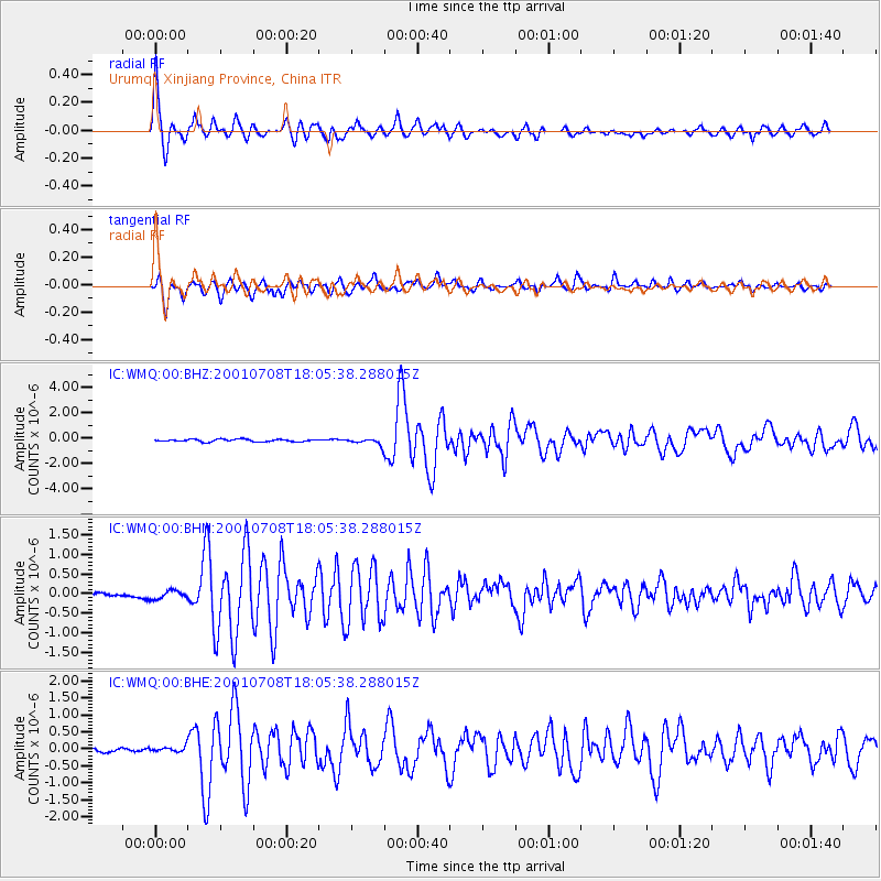
Earthquake location: New Britain Region, P.N.G.
Earthquake latitude/longitude: -6.7/152.1
Earthquake time(UTC): 2001/07/08 (189) 17:54:18 GMT
Earthquake Depth: 10 km
Earthquake Magnitude: 6.0 MB, 5.7 MS, 6.2 MW, 5.7 ML
Earthquake Catalog/Contributor: WHDF/NEIC
Network: IC New China Digital Seismograph Network
Station: WMQ Urumqi, Xinjiang Province, China
Lat/Lon: 43.82 N/87.69 E
Elevation: 903 m
Distance: 76.6 deg
Az: 317.857 deg
Baz: 112.953 deg
Ray Param: 0.05085556
Estimated Moho Depth: 46.0 km
Estimated Crust Vp/Vs: 1.82
Assumed Crust Vp: 6.242 km/s
Estimated Crust Vs: 3.43 km/s
Estimated Crust Poisson's Ratio: 0.28
Radial Match: 95.44315 %
Radial Bump: 400
Transverse Match: 87.78209 %
Transverse Bump: 400
SOD ConfigId: 4714
Insert Time: 2010-03-05 00:01:41.476 +0000
GWidth: 2.5
Max Bumps: 400
Tol: 0.001

Signal To Noise

ChannelStoNSTALTA
IC:WMQ:00:BHN:20010708T18:05:38.288015Z1.96399041.06848326E-75.440369E-8
IC:WMQ:00:BHE:20010708T18:05:38.288015Z1.63205297.178272E-84.3983086E-8
IC:WMQ:00:BHZ:20010708T18:05:38.288015Z2.73522542.5558256E-79.344113E-8
Arrivals
Ps6.2 SECOND
PpPs20 SECOND
PsPs/PpSs26 SECOND