WMQ Urumqi, Xinjiang Province, China - Earthquake Result Viewer
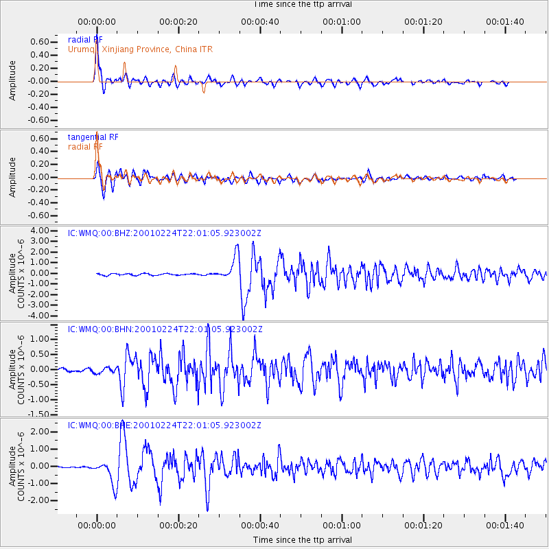
Earthquake location: Off East Coast Of Honshu, Japan
Earthquake latitude/longitude: 37.2/142.1
Earthquake time(UTC): 2001/02/24 (055) 21:53:54 GMT
Earthquake Depth: 33 km
Earthquake Magnitude: 5.4 MB, 5.5 MS, 5.9 MW, 5.8 MW
Earthquake Catalog/Contributor: WHDF/NEIC
Network: IC New China Digital Seismograph Network
Station: WMQ Urumqi, Xinjiang Province, China
Lat/Lon: 43.82 N/87.69 E
Elevation: 903 m
Distance: 41.3 deg
Az: 296.791 deg
Baz: 79.901 deg
Ray Param: 0.073824085
Estimated Moho Depth: 41.0 km
Estimated Crust Vp/Vs: 2.04
Assumed Crust Vp: 6.242 km/s
Estimated Crust Vs: 3.06 km/s
Estimated Crust Poisson's Ratio: 0.34
Radial Match: 95.23016 %
Radial Bump: 400
Transverse Match: 94.15345 %
Transverse Bump: 400
SOD ConfigId: 3753
Insert Time: 2010-03-05 00:01:51.153 +0000
GWidth: 2.5
Max Bumps: 400
Tol: 0.001

Signal To Noise

ChannelStoNSTALTA
IC:WMQ:00:BHN:20010224T22:01:05.923002Z1.40277658.73854E-86.22946E-8
IC:WMQ:00:BHE:20010224T22:01:05.923002Z19.3422247.277945E-73.762724E-8
IC:WMQ:00:BHZ:20010224T22:01:05.923002Z15.4639941.200549E-67.763512E-8
Arrivals
Ps7.2 SECOND
PpPs19 SECOND
PsPs/PpSs26 SECOND