You are here: Home > Network List > TA - USArray Transportable Network (new EarthScope stations) Stations List
> Station I23K Minto, Yukon-Koyukuk, AK, USA > Earthquake Result Viewer
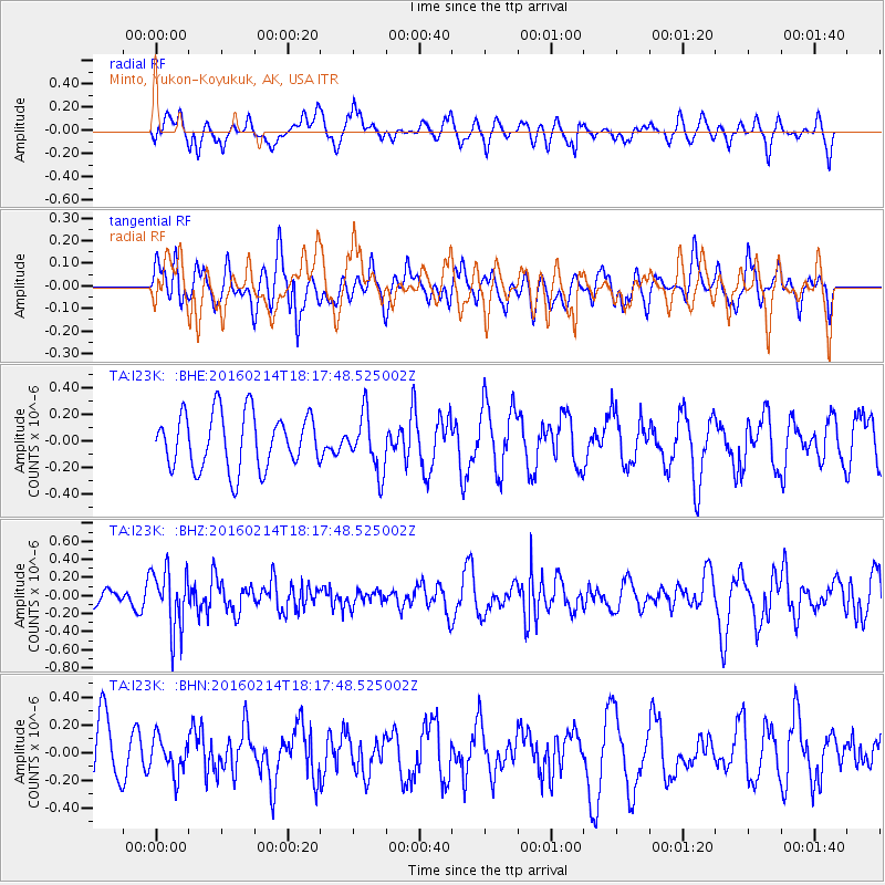
I23K Minto, Yukon-Koyukuk, AK, USA - Earthquake Result Viewer
*The percent match for this event was below the threshold and hence no stack was calculated.
| Earthquake location: |
Southeast Of Honshu, Japan |
| Earthquake latitude/longitude: |
30.3/138.9 |
| Earthquake time(UTC): |
2016/02/14 (045) 18:09:26 GMT |
| Earthquake Depth: |
413 km |
| Earthquake Magnitude: |
5.7 MB |
| Earthquake Catalog/Contributor: |
NEIC PDE/NEIC COMCAT |
|
| Network: |
TA USArray Transportable Network (new EarthScope stations) |
| Station: |
I23K Minto, Yukon-Koyukuk, AK, USA |
| Lat/Lon: |
65.15 N/149.36 W |
| Elevation: |
149 m |
|
| Distance: |
55.3 deg |
| Az: |
29.226 deg |
| Baz: |
267.714 deg |
| Ray Param: |
$rayparam |
*The percent match for this event was below the threshold and hence was not used in the summary stack. |
|
| Radial Match: |
53.20083 % |
| Radial Bump: |
400 |
| Transverse Match: |
42.583668 % |
| Transverse Bump: |
400 |
| SOD ConfigId: |
7422571 |
| Insert Time: |
2019-04-21 22:21:00.823 +0000 |
| GWidth: |
2.5 |
| Max Bumps: |
400 |
| Tol: |
0.001 |
|
Signal To Noise
| Channel | StoN | STA | LTA |
| TA:I23K: :BHZ:20160214T18:17:48.525002Z | 2.4632874 | 3.3157662E-7 | 1.3460736E-7 |
| TA:I23K: :BHN:20160214T18:17:48.525002Z | 0.6360847 | 1.2836716E-7 | 2.018083E-7 |
| TA:I23K: :BHE:20160214T18:17:48.525002Z | 1.0359997 | 2.1385085E-7 | 2.0641981E-7 |
| Arrivals |
| Ps | |
| PpPs | |
| PsPs/PpSs | |


