You are here: Home > Network List > TA - USArray Transportable Network (new EarthScope stations) Stations List
> Station J26L Joseph Creek, AK, USA > Earthquake Result Viewer
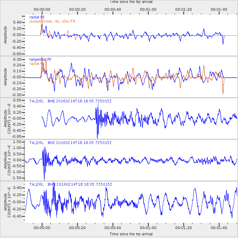
J26L Joseph Creek, AK, USA - Earthquake Result Viewer
*The percent match for this event was below the threshold and hence no stack was calculated.
| Earthquake location: |
Southeast Of Honshu, Japan |
| Earthquake latitude/longitude: |
30.3/138.9 |
| Earthquake time(UTC): |
2016/02/14 (045) 18:09:26 GMT |
| Earthquake Depth: |
413 km |
| Earthquake Magnitude: |
5.7 MB |
| Earthquake Catalog/Contributor: |
NEIC PDE/NEIC COMCAT |
|
| Network: |
TA USArray Transportable Network (new EarthScope stations) |
| Station: |
J26L Joseph Creek, AK, USA |
| Lat/Lon: |
64.50 N/143.56 W |
| Elevation: |
1144 m |
|
| Distance: |
57.8 deg |
| Az: |
29.975 deg |
| Baz: |
273.368 deg |
| Ray Param: |
$rayparam |
*The percent match for this event was below the threshold and hence was not used in the summary stack. |
|
| Radial Match: |
56.365177 % |
| Radial Bump: |
400 |
| Transverse Match: |
67.68771 % |
| Transverse Bump: |
400 |
| SOD ConfigId: |
7422571 |
| Insert Time: |
2019-04-21 22:21:02.785 +0000 |
| GWidth: |
2.5 |
| Max Bumps: |
400 |
| Tol: |
0.001 |
|
Signal To Noise
| Channel | StoN | STA | LTA |
| TA:J26L: :BHZ:20160214T18:18:05.725015Z | 3.3507543 | 5.215684E-7 | 1.5565699E-7 |
| TA:J26L: :BHN:20160214T18:18:05.725015Z | 1.2853535 | 1.9819755E-7 | 1.5419693E-7 |
| TA:J26L: :BHE:20160214T18:18:05.725015Z | 1.7886336 | 2.2356099E-7 | 1.2498981E-7 |
| Arrivals |
| Ps | |
| PpPs | |
| PsPs/PpSs | |


