
WMQ Urumqi, Xinjiang Province, China - Earthquake Result Viewer
| ||||||||||||||||||
| ||||||||||||||||||
| ||||||||||||||||||
|
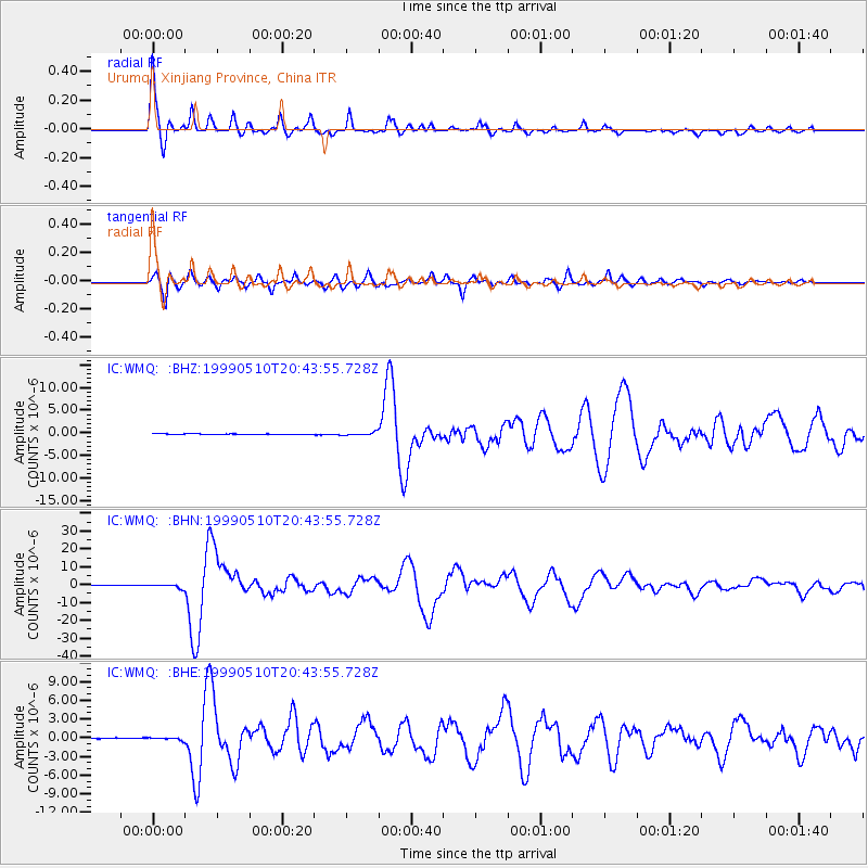
Signal To Noise
| Channel | StoN | STA | LTA |
| IC:WMQ: :BHN:19990510T20:43:55.728Z | 7.5857244 | 1.0671203E-6 | 1.406748E-7 |
| IC:WMQ: :BHE:19990510T20:43:55.728Z | 2.2245266 | 1.9936027E-7 | 8.961919E-8 |
| IC:WMQ: :BHZ:19990510T20:43:55.728Z | 4.4729576 | 3.36488E-7 | 7.522718E-8 |
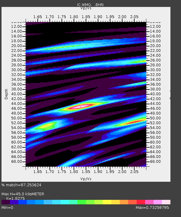
| Arrivals | |
| Ps | 6.1 SECOND |
| PpPs | 20 SECOND |
| PsPs/PpSs | 26 SECOND |

