You are here: Home > Network List > AK - Alaska Regional Network Stations List
> Station MDM Murphy Dome > Earthquake Result Viewer
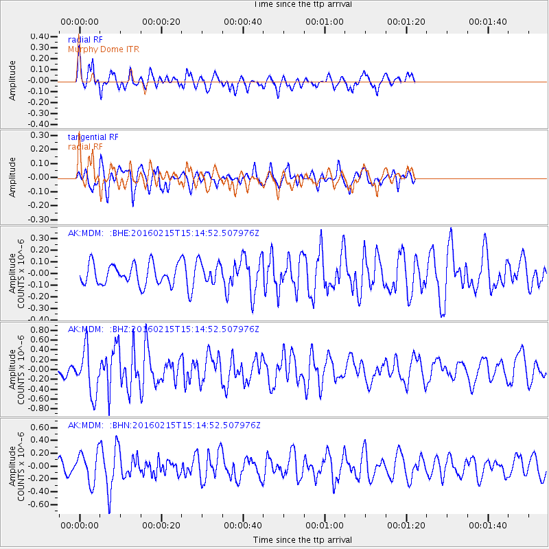
MDM Murphy Dome - Earthquake Result Viewer
*The percent match for this event was below the threshold and hence no stack was calculated.
| Earthquake location: |
Tonga Islands |
| Earthquake latitude/longitude: |
-21.0/-175.5 |
| Earthquake time(UTC): |
2016/02/15 (046) 15:02:33 GMT |
| Earthquake Depth: |
10 km |
| Earthquake Magnitude: |
5.7 MB |
| Earthquake Catalog/Contributor: |
NEIC PDE/NEIC COMCAT |
|
| Network: |
AK Alaska Regional Network |
| Station: |
MDM Murphy Dome |
| Lat/Lon: |
64.96 N/148.23 W |
| Elevation: |
634 m |
|
| Distance: |
88.2 deg |
| Az: |
11.259 deg |
| Baz: |
205.38 deg |
| Ray Param: |
$rayparam |
*The percent match for this event was below the threshold and hence was not used in the summary stack. |
|
| Radial Match: |
62.935287 % |
| Radial Bump: |
344 |
| Transverse Match: |
72.79608 % |
| Transverse Bump: |
400 |
| SOD ConfigId: |
7422571 |
| Insert Time: |
2019-04-21 22:24:19.583 +0000 |
| GWidth: |
2.5 |
| Max Bumps: |
400 |
| Tol: |
0.001 |
|
Signal To Noise
| Channel | StoN | STA | LTA |
| AK:MDM: :BHZ:20160215T15:14:52.507976Z | 3.8640447 | 4.700709E-7 | 1.2165255E-7 |
| AK:MDM: :BHN:20160215T15:14:52.507976Z | 2.2717001 | 2.459718E-7 | 1.0827651E-7 |
| AK:MDM: :BHE:20160215T15:14:52.507976Z | 0.8669195 | 7.7404835E-8 | 8.928722E-8 |
| Arrivals |
| Ps | |
| PpPs | |
| PsPs/PpSs | |


