You are here: Home > Network List > TA - USArray Transportable Network (new EarthScope stations) Stations List
> Station J26L Joseph Creek, AK, USA > Earthquake Result Viewer
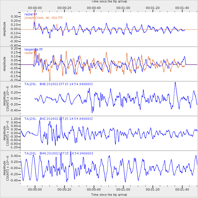
J26L Joseph Creek, AK, USA - Earthquake Result Viewer
*The percent match for this event was below the threshold and hence no stack was calculated.
| Earthquake location: |
Tonga Islands |
| Earthquake latitude/longitude: |
-21.0/-175.5 |
| Earthquake time(UTC): |
2016/02/15 (046) 15:02:33 GMT |
| Earthquake Depth: |
10 km |
| Earthquake Magnitude: |
5.7 MB |
| Earthquake Catalog/Contributor: |
NEIC PDE/NEIC COMCAT |
|
| Network: |
TA USArray Transportable Network (new EarthScope stations) |
| Station: |
J26L Joseph Creek, AK, USA |
| Lat/Lon: |
64.50 N/143.56 W |
| Elevation: |
1144 m |
|
| Distance: |
88.7 deg |
| Az: |
13.247 deg |
| Baz: |
209.647 deg |
| Ray Param: |
$rayparam |
*The percent match for this event was below the threshold and hence was not used in the summary stack. |
|
| Radial Match: |
54.16499 % |
| Radial Bump: |
400 |
| Transverse Match: |
45.35233 % |
| Transverse Bump: |
399 |
| SOD ConfigId: |
7422571 |
| Insert Time: |
2019-04-21 22:28:58.228 +0000 |
| GWidth: |
2.5 |
| Max Bumps: |
400 |
| Tol: |
0.001 |
|
Signal To Noise
| Channel | StoN | STA | LTA |
| TA:J26L: :BHZ:20160215T15:14:54.949993Z | 3.304701 | 4.609294E-7 | 1.3947688E-7 |
| TA:J26L: :BHN:20160215T15:14:54.949993Z | 1.8346936 | 2.832564E-7 | 1.5438894E-7 |
| TA:J26L: :BHE:20160215T15:14:54.949993Z | 1.2130084 | 1.0123496E-7 | 8.3457756E-8 |
| Arrivals |
| Ps | |
| PpPs | |
| PsPs/PpSs | |


