You are here: Home > Network List > TA - USArray Transportable Network (new EarthScope stations) Stations List
> Station L20K Farewell, AK, USA > Earthquake Result Viewer
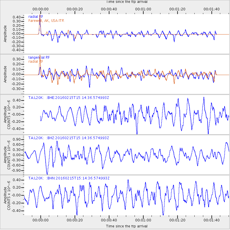
L20K Farewell, AK, USA - Earthquake Result Viewer
*The percent match for this event was below the threshold and hence no stack was calculated.
| Earthquake location: |
Tonga Islands |
| Earthquake latitude/longitude: |
-21.0/-175.5 |
| Earthquake time(UTC): |
2016/02/15 (046) 15:02:33 GMT |
| Earthquake Depth: |
10 km |
| Earthquake Magnitude: |
5.7 MB |
| Earthquake Catalog/Contributor: |
NEIC PDE/NEIC COMCAT |
|
| Network: |
TA USArray Transportable Network (new EarthScope stations) |
| Station: |
L20K Farewell, AK, USA |
| Lat/Lon: |
62.48 N/153.88 W |
| Elevation: |
673 m |
|
| Distance: |
85.0 deg |
| Az: |
9.903 deg |
| Baz: |
200.237 deg |
| Ray Param: |
$rayparam |
*The percent match for this event was below the threshold and hence was not used in the summary stack. |
|
| Radial Match: |
67.1797 % |
| Radial Bump: |
400 |
| Transverse Match: |
60.407207 % |
| Transverse Bump: |
400 |
| SOD ConfigId: |
7422571 |
| Insert Time: |
2019-04-21 22:29:02.560 +0000 |
| GWidth: |
2.5 |
| Max Bumps: |
400 |
| Tol: |
0.001 |
|
Signal To Noise
| Channel | StoN | STA | LTA |
| TA:L20K: :BHZ:20160215T15:14:36.574993Z | 3.8272822 | 5.6649884E-7 | 1.4801596E-7 |
| TA:L20K: :BHN:20160215T15:14:36.574993Z | 0.77998894 | 1.2774362E-7 | 1.6377619E-7 |
| TA:L20K: :BHE:20160215T15:14:36.574993Z | 1.2364281 | 1.6409695E-7 | 1.3271855E-7 |
| Arrivals |
| Ps | |
| PpPs | |
| PsPs/PpSs | |


