You are here: Home > Network List > UW - Pacific Northwest Regional Seismic Network Stations List
> Station YACT Amboy, WA, USA > Earthquake Result Viewer
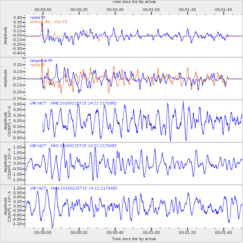
YACT Amboy, WA, USA - Earthquake Result Viewer
*The percent match for this event was below the threshold and hence no stack was calculated.
| Earthquake location: |
Tonga Islands |
| Earthquake latitude/longitude: |
-21.0/-175.5 |
| Earthquake time(UTC): |
2016/02/15 (046) 15:02:33 GMT |
| Earthquake Depth: |
10 km |
| Earthquake Magnitude: |
5.7 MB |
| Earthquake Catalog/Contributor: |
NEIC PDE/NEIC COMCAT |
|
| Network: |
UW Pacific Northwest Regional Seismic Network |
| Station: |
YACT Amboy, WA, USA |
| Lat/Lon: |
45.93 N/122.42 W |
| Elevation: |
211 m |
|
| Distance: |
82.2 deg |
| Az: |
34.29 deg |
| Baz: |
228.958 deg |
| Ray Param: |
$rayparam |
*The percent match for this event was below the threshold and hence was not used in the summary stack. |
|
| Radial Match: |
60.46201 % |
| Radial Bump: |
400 |
| Transverse Match: |
36.16051 % |
| Transverse Bump: |
400 |
| SOD ConfigId: |
7422571 |
| Insert Time: |
2019-04-21 22:29:53.994 +0000 |
| GWidth: |
2.5 |
| Max Bumps: |
400 |
| Tol: |
0.001 |
|
Signal To Noise
| Channel | StoN | STA | LTA |
| UW:YACT: :HHZ:20160215T15:14:22.217998Z | 2.6832058 | 7.292807E-7 | 2.7179456E-7 |
| UW:YACT: :HHN:20160215T15:14:22.217998Z | 1.8766781 | 6.503197E-7 | 3.4652706E-7 |
| UW:YACT: :HHE:20160215T15:14:22.217998Z | 1.4887094 | 6.0710636E-7 | 4.0780716E-7 |
| Arrivals |
| Ps | |
| PpPs | |
| PsPs/PpSs | |


