You are here: Home > Network List > AG - Arkansas Seismic Network Stations List
> Station LCAR Lake Charles,AR > Earthquake Result Viewer
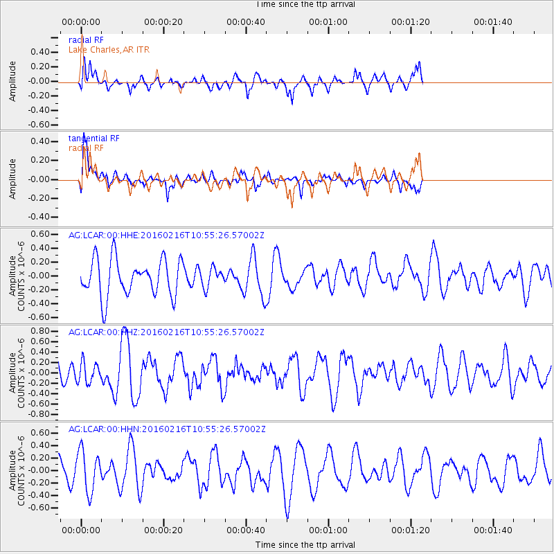
LCAR Lake Charles,AR - Earthquake Result Viewer
*The percent match for this event was below the threshold and hence no stack was calculated.
| Earthquake location: |
Near Coast Of Peru |
| Earthquake latitude/longitude: |
-16.4/-73.5 |
| Earthquake time(UTC): |
2016/02/16 (047) 10:46:27 GMT |
| Earthquake Depth: |
13 km |
| Earthquake Magnitude: |
5.7 MWW, 5.6 MWB, 5.7 MWC |
| Earthquake Catalog/Contributor: |
NEIC PDE/NEIC COMCAT |
|
| Network: |
AG Arkansas Seismic Network |
| Station: |
LCAR Lake Charles,AR |
| Lat/Lon: |
36.07 N/91.15 W |
| Elevation: |
103 m |
|
| Distance: |
54.8 deg |
| Az: |
342.545 deg |
| Baz: |
159.187 deg |
| Ray Param: |
$rayparam |
*The percent match for this event was below the threshold and hence was not used in the summary stack. |
|
| Radial Match: |
72.93053 % |
| Radial Bump: |
400 |
| Transverse Match: |
69.57593 % |
| Transverse Bump: |
400 |
| SOD ConfigId: |
7422571 |
| Insert Time: |
2019-04-21 22:33:25.894 +0000 |
| GWidth: |
2.5 |
| Max Bumps: |
400 |
| Tol: |
0.001 |
|
Signal To Noise
| Channel | StoN | STA | LTA |
| AG:LCAR:00:HHZ:20160216T10:55:26.57002Z | 0.7115757 | 1.9577575E-7 | 2.751299E-7 |
| AG:LCAR:00:HHN:20160216T10:55:26.57002Z | 1.1425627 | 3.323223E-7 | 2.9085692E-7 |
| AG:LCAR:00:HHE:20160216T10:55:26.57002Z | 0.5234248 | 1.3988719E-7 | 2.6725368E-7 |
| Arrivals |
| Ps | |
| PpPs | |
| PsPs/PpSs | |


