You are here: Home > Network List > AZ - ANZA Regional Network Stations List
> Station LVA2 AZ.LVA2 > Earthquake Result Viewer
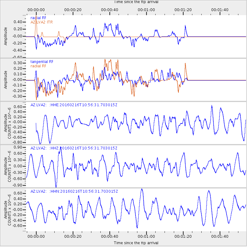
LVA2 AZ.LVA2 - Earthquake Result Viewer
*The percent match for this event was below the threshold and hence no stack was calculated.
| Earthquake location: |
Near Coast Of Peru |
| Earthquake latitude/longitude: |
-16.4/-73.5 |
| Earthquake time(UTC): |
2016/02/16 (047) 10:46:27 GMT |
| Earthquake Depth: |
13 km |
| Earthquake Magnitude: |
5.7 MWW, 5.6 MWB, 5.7 MWC |
| Earthquake Catalog/Contributor: |
NEIC PDE/NEIC COMCAT |
|
| Network: |
AZ ANZA Regional Network |
| Station: |
LVA2 AZ.LVA2 |
| Lat/Lon: |
33.35 N/116.56 W |
| Elevation: |
1435 m |
|
| Distance: |
64.3 deg |
| Az: |
320.678 deg |
| Baz: |
133.4 deg |
| Ray Param: |
$rayparam |
*The percent match for this event was below the threshold and hence was not used in the summary stack. |
|
| Radial Match: |
40.52793 % |
| Radial Bump: |
400 |
| Transverse Match: |
58.512154 % |
| Transverse Bump: |
400 |
| SOD ConfigId: |
7422571 |
| Insert Time: |
2019-04-21 22:33:45.343 +0000 |
| GWidth: |
2.5 |
| Max Bumps: |
400 |
| Tol: |
0.001 |
|
Signal To Noise
| Channel | StoN | STA | LTA |
| AZ:LVA2: :HHZ:20160216T10:56:31.703015Z | 1.4401108 | 3.376979E-7 | 2.344944E-7 |
| AZ:LVA2: :HHN:20160216T10:56:31.703015Z | 1.0823684 | 3.9116827E-7 | 3.614003E-7 |
| AZ:LVA2: :HHE:20160216T10:56:31.703015Z | 0.6673072 | 2.0776127E-7 | 3.1134277E-7 |
| Arrivals |
| Ps | |
| PpPs | |
| PsPs/PpSs | |


