You are here: Home > Network List > US - United States National Seismic Network Stations List
> Station AMTX Amarillo, Texas, USA > Earthquake Result Viewer
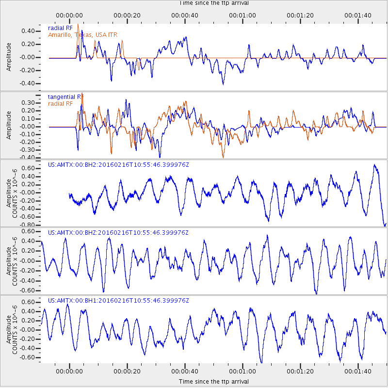
AMTX Amarillo, Texas, USA - Earthquake Result Viewer
*The percent match for this event was below the threshold and hence no stack was calculated.
| Earthquake location: |
Near Coast Of Peru |
| Earthquake latitude/longitude: |
-16.4/-73.5 |
| Earthquake time(UTC): |
2016/02/16 (047) 10:46:27 GMT |
| Earthquake Depth: |
13 km |
| Earthquake Magnitude: |
5.7 MWW, 5.6 MWB, 5.7 MWC |
| Earthquake Catalog/Contributor: |
NEIC PDE/NEIC COMCAT |
|
| Network: |
US United States National Seismic Network |
| Station: |
AMTX Amarillo, Texas, USA |
| Lat/Lon: |
34.53 N/101.41 W |
| Elevation: |
1010 m |
|
| Distance: |
57.2 deg |
| Az: |
332.668 deg |
| Baz: |
147.743 deg |
| Ray Param: |
$rayparam |
*The percent match for this event was below the threshold and hence was not used in the summary stack. |
|
| Radial Match: |
57.43367 % |
| Radial Bump: |
400 |
| Transverse Match: |
55.414055 % |
| Transverse Bump: |
400 |
| SOD ConfigId: |
7422571 |
| Insert Time: |
2019-04-21 22:39:06.282 +0000 |
| GWidth: |
2.5 |
| Max Bumps: |
400 |
| Tol: |
0.001 |
|
Signal To Noise
| Channel | StoN | STA | LTA |
| US:AMTX:00:BHZ:20160216T10:55:46.399976Z | 1.5232748 | 2.1337588E-7 | 1.4007709E-7 |
| US:AMTX:00:BH1:20160216T10:55:46.399976Z | 1.8290807 | 3.65415E-7 | 1.9978069E-7 |
| US:AMTX:00:BH2:20160216T10:55:46.399976Z | 1.8216227 | 2.9702892E-7 | 1.6305732E-7 |
| Arrivals |
| Ps | |
| PpPs | |
| PsPs/PpSs | |


