You are here: Home > Network List > US - United States National Seismic Network Stations List
> Station RLMT Red Lodge, Montana, USA > Earthquake Result Viewer
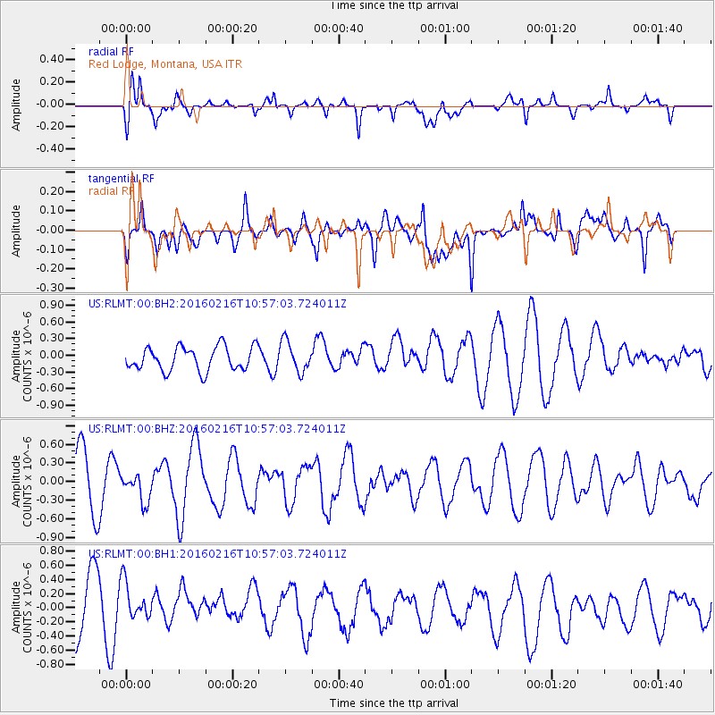
RLMT Red Lodge, Montana, USA - Earthquake Result Viewer
*The percent match for this event was below the threshold and hence no stack was calculated.
| Earthquake location: |
Near Coast Of Peru |
| Earthquake latitude/longitude: |
-16.4/-73.5 |
| Earthquake time(UTC): |
2016/02/16 (047) 10:46:27 GMT |
| Earthquake Depth: |
13 km |
| Earthquake Magnitude: |
5.7 MWW, 5.6 MWB, 5.7 MWC |
| Earthquake Catalog/Contributor: |
NEIC PDE/NEIC COMCAT |
|
| Network: |
US United States National Seismic Network |
| Station: |
RLMT Red Lodge, Montana, USA |
| Lat/Lon: |
45.12 N/109.27 W |
| Elevation: |
2086 m |
|
| Distance: |
69.3 deg |
| Az: |
333.778 deg |
| Baz: |
143.206 deg |
| Ray Param: |
$rayparam |
*The percent match for this event was below the threshold and hence was not used in the summary stack. |
|
| Radial Match: |
77.62454 % |
| Radial Bump: |
400 |
| Transverse Match: |
54.24244 % |
| Transverse Bump: |
400 |
| SOD ConfigId: |
7422571 |
| Insert Time: |
2019-04-21 22:39:15.828 +0000 |
| GWidth: |
2.5 |
| Max Bumps: |
400 |
| Tol: |
0.001 |
|
Signal To Noise
| Channel | StoN | STA | LTA |
| US:RLMT:00:BHZ:20160216T10:57:03.724011Z | 0.4313024 | 2.2541833E-7 | 5.226457E-7 |
| US:RLMT:00:BH1:20160216T10:57:03.724011Z | 0.7336728 | 3.1546958E-7 | 4.2998673E-7 |
| US:RLMT:00:BH2:20160216T10:57:03.724011Z | 1.3137337 | 2.79892E-7 | 2.1305078E-7 |
| Arrivals |
| Ps | |
| PpPs | |
| PsPs/PpSs | |


