You are here: Home > Network List > UW - Pacific Northwest Regional Seismic Network Stations List
> Station UMAT Pilot Rock, OR, USA > Earthquake Result Viewer
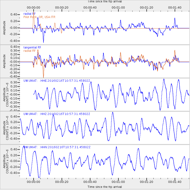
UMAT Pilot Rock, OR, USA - Earthquake Result Viewer
*The percent match for this event was below the threshold and hence no stack was calculated.
| Earthquake location: |
Near Coast Of Peru |
| Earthquake latitude/longitude: |
-16.4/-73.5 |
| Earthquake time(UTC): |
2016/02/16 (047) 10:46:27 GMT |
| Earthquake Depth: |
13 km |
| Earthquake Magnitude: |
5.7 MWW, 5.6 MWB, 5.7 MWC |
| Earthquake Catalog/Contributor: |
NEIC PDE/NEIC COMCAT |
|
| Network: |
UW Pacific Northwest Regional Seismic Network |
| Station: |
UMAT Pilot Rock, OR, USA |
| Lat/Lon: |
45.29 N/118.96 W |
| Elevation: |
1318 m |
|
| Distance: |
73.9 deg |
| Az: |
328.456 deg |
| Baz: |
134.663 deg |
| Ray Param: |
$rayparam |
*The percent match for this event was below the threshold and hence was not used in the summary stack. |
|
| Radial Match: |
61.72013 % |
| Radial Bump: |
400 |
| Transverse Match: |
59.889652 % |
| Transverse Bump: |
400 |
| SOD ConfigId: |
7422571 |
| Insert Time: |
2019-04-21 22:39:31.884 +0000 |
| GWidth: |
2.5 |
| Max Bumps: |
400 |
| Tol: |
0.001 |
|
Signal To Noise
| Channel | StoN | STA | LTA |
| UW:UMAT: :HHZ:20160216T10:57:31.45802Z | 0.81567776 | 1.7197542E-7 | 2.1083744E-7 |
| UW:UMAT: :HHN:20160216T10:57:31.45802Z | 1.3677739 | 3.5277725E-7 | 2.5792073E-7 |
| UW:UMAT: :HHE:20160216T10:57:31.45802Z | 1.289563 | 1.6224757E-7 | 1.2581594E-7 |
| Arrivals |
| Ps | |
| PpPs | |
| PsPs/PpSs | |


