WMQ Urumqi, Xinjiang Province, China - Earthquake Result Viewer
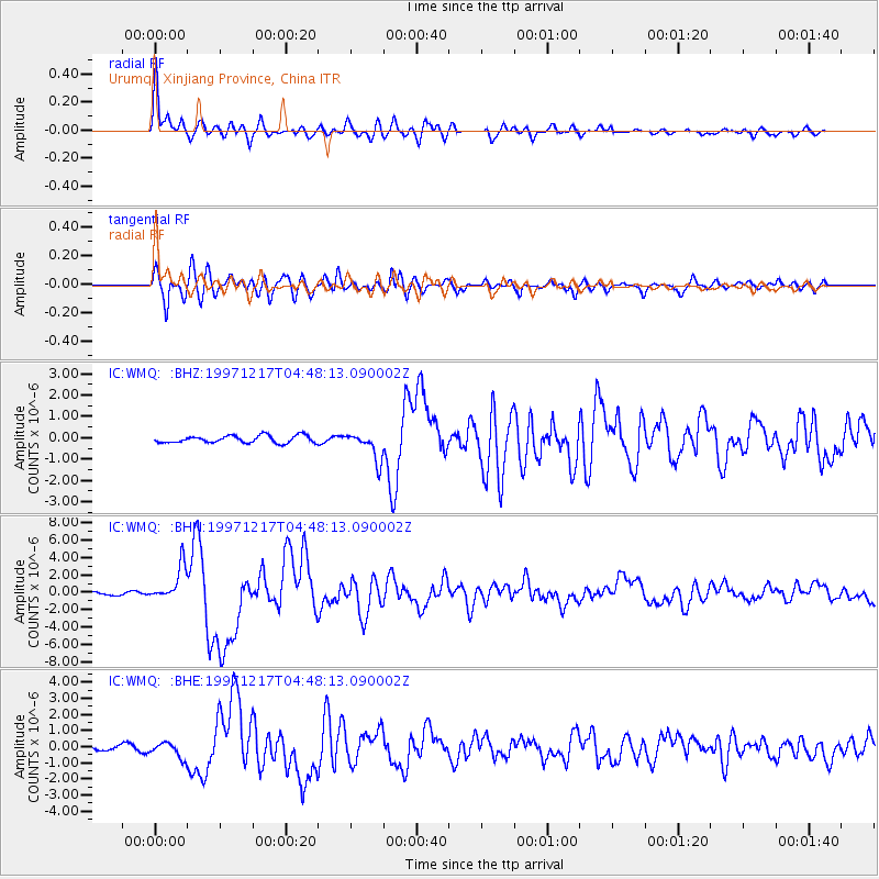
Earthquake location: Rat Islands, Aleutian Islands
Earthquake latitude/longitude: 51.2/178.9
Earthquake time(UTC): 1997/12/17 (351) 04:38:51 GMT
Earthquake Depth: 20 km
Earthquake Magnitude: 5.8 MB, 6.5 MS, 6.7 UNKNOWN, 6.1 ME
Earthquake Catalog/Contributor: WHDF/NEIC
Network: IC New China Digital Seismograph Network
Station: WMQ Urumqi, Xinjiang Province, China
Lat/Lon: 43.82 N/87.69 E
Elevation: 903 m
Distance: 58.2 deg
Az: 301.633 deg
Baz: 47.755 deg
Ray Param: 0.06297232
Estimated Moho Depth: 10.0 km
Estimated Crust Vp/Vs: 1.81
Assumed Crust Vp: 6.242 km/s
Estimated Crust Vs: 3.453 km/s
Estimated Crust Poisson's Ratio: 0.28
Radial Match: 94.57433 %
Radial Bump: 400
Transverse Match: 87.09416 %
Transverse Bump: 400
SOD ConfigId: 4480
Insert Time: 2010-03-05 00:04:59.274 +0000
GWidth: 2.5
Max Bumps: 400
Tol: 0.001

Signal To Noise

ChannelStoNSTALTA
IC:WMQ: :BHN:19971217T04:48:13.090002Z9.3322642.0017958E-62.145027E-7
IC:WMQ: :BHE:19971217T04:48:13.090002Z4.2736394.7033743E-71.1005548E-7
IC:WMQ: :BHZ:19971217T04:48:13.090002Z3.90911086.6207195E-71.6936639E-7
Arrivals
Ps1.4 SECOND
PpPs4.3 SECOND
PsPs/PpSs5.7 SECOND