
WMQ Urumqi, Xinjiang Province, China - Earthquake Result Viewer
| ||||||||||||||||||
| ||||||||||||||||||
| ||||||||||||||||||
|
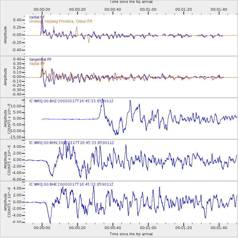
Signal To Noise
| Channel | StoN | STA | LTA |
| IC:WMQ:00:BHN:20030317T16:45:33.859011Z | 15.797928 | 1.467269E-6 | 9.287731E-8 |
| IC:WMQ:00:BHE:20030317T16:45:33.859011Z | 34.50921 | 2.558527E-6 | 7.414042E-8 |
| IC:WMQ:00:BHZ:20030317T16:45:33.859011Z | 68.071396 | 7.3025267E-6 | 1.0727746E-7 |
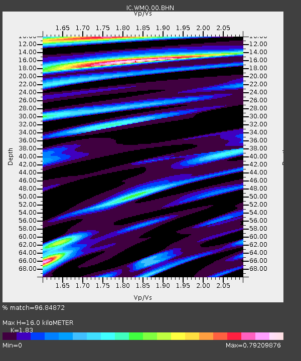
| Arrivals | |
| Ps | 2.2 SECOND |
| PpPs | 6.9 SECOND |
| PsPs/PpSs | 9.2 SECOND |

