You are here: Home > Network List > AK - Alaska Regional Network Stations List
> Station CUT Chulitna, AK, USA > Earthquake Result Viewer
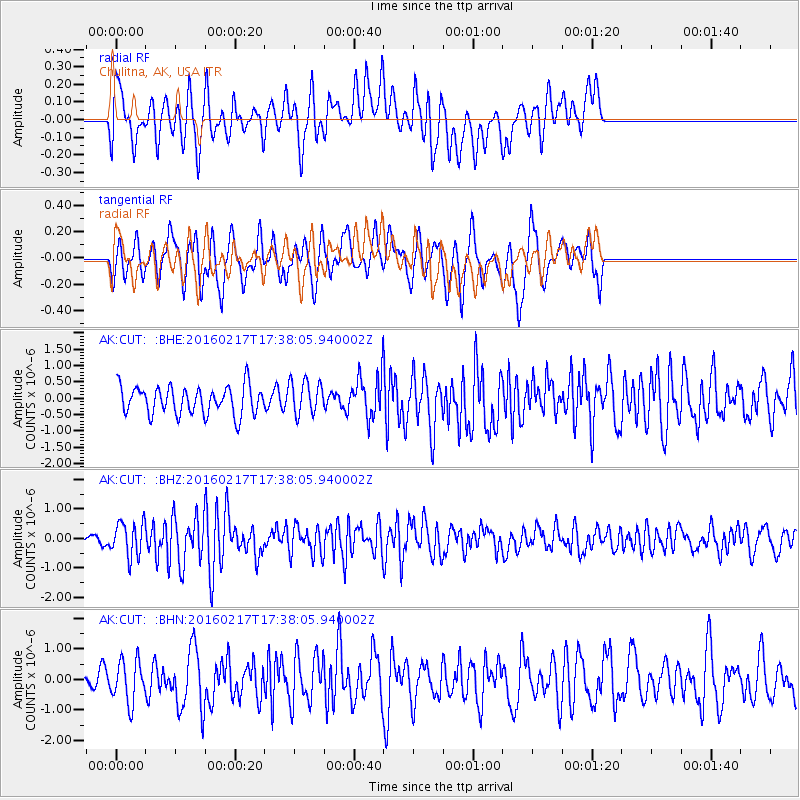
CUT Chulitna, AK, USA - Earthquake Result Viewer
*The percent match for this event was below the threshold and hence no stack was calculated.
| Earthquake location: |
Halmahera, Indonesia |
| Earthquake latitude/longitude: |
0.9/129.1 |
| Earthquake time(UTC): |
2016/02/17 (048) 17:26:03 GMT |
| Earthquake Depth: |
10 km |
| Earthquake Magnitude: |
5.8 MB |
| Earthquake Catalog/Contributor: |
NEIC PDE/NEIC ALERT |
|
| Network: |
AK Alaska Regional Network |
| Station: |
CUT Chulitna, AK, USA |
| Lat/Lon: |
62.41 N/150.26 W |
| Elevation: |
574 m |
|
| Distance: |
84.9 deg |
| Az: |
27.471 deg |
| Baz: |
262.116 deg |
| Ray Param: |
$rayparam |
*The percent match for this event was below the threshold and hence was not used in the summary stack. |
|
| Radial Match: |
52.446606 % |
| Radial Bump: |
400 |
| Transverse Match: |
66.24961 % |
| Transverse Bump: |
400 |
| SOD ConfigId: |
7422571 |
| Insert Time: |
2019-04-21 22:46:52.107 +0000 |
| GWidth: |
2.5 |
| Max Bumps: |
400 |
| Tol: |
0.001 |
|
Signal To Noise
| Channel | StoN | STA | LTA |
| AK:CUT: :BHZ:20160217T17:38:05.940002Z | 2.5103335 | 5.902066E-7 | 2.3511082E-7 |
| AK:CUT: :BHN:20160217T17:38:05.940002Z | 1.5004106 | 6.838389E-7 | 4.5576783E-7 |
| AK:CUT: :BHE:20160217T17:38:05.940002Z | 1.1356956 | 4.7069292E-7 | 4.144534E-7 |
| Arrivals |
| Ps | |
| PpPs | |
| PsPs/PpSs | |


