You are here: Home > Network List > CN - Canadian National Seismograph Network Stations List
> Station INK INUVIK, NT > Earthquake Result Viewer
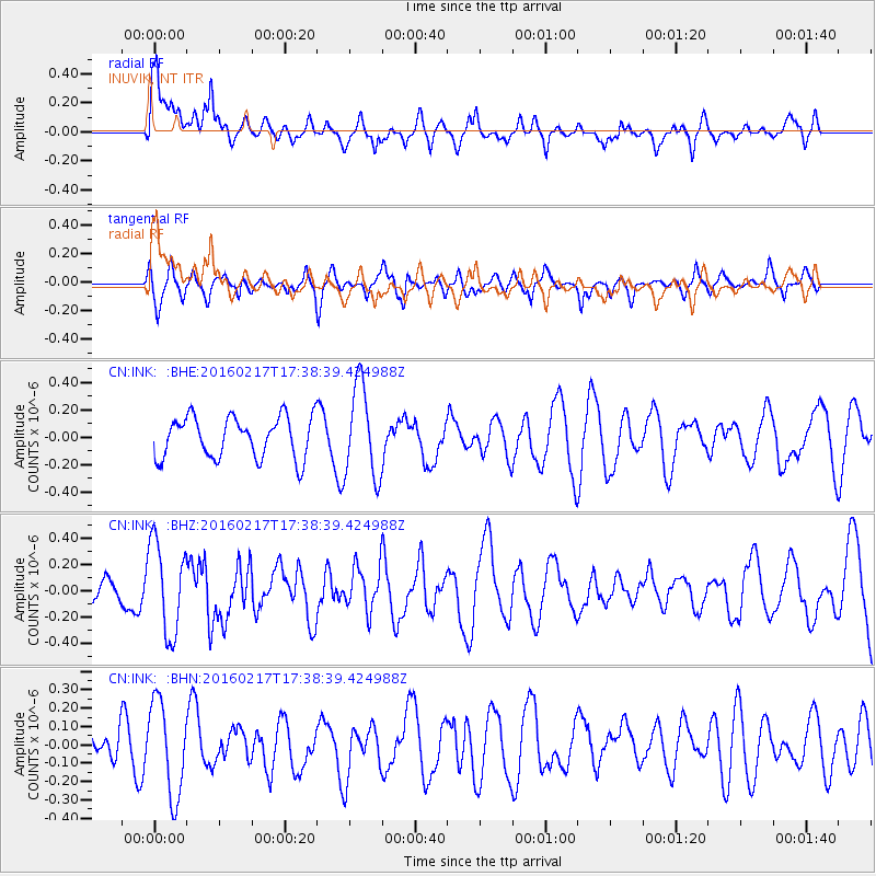
INK INUVIK, NT - Earthquake Result Viewer
*The percent match for this event was below the threshold and hence no stack was calculated.
| Earthquake location: |
Halmahera, Indonesia |
| Earthquake latitude/longitude: |
0.9/129.1 |
| Earthquake time(UTC): |
2016/02/17 (048) 17:26:03 GMT |
| Earthquake Depth: |
10 km |
| Earthquake Magnitude: |
5.8 MB |
| Earthquake Catalog/Contributor: |
NEIC PDE/NEIC ALERT |
|
| Network: |
CN Canadian National Seismograph Network |
| Station: |
INK INUVIK, NT |
| Lat/Lon: |
68.31 N/133.53 W |
| Elevation: |
44 m |
|
| Distance: |
91.9 deg |
| Az: |
21.648 deg |
| Baz: |
277.189 deg |
| Ray Param: |
$rayparam |
*The percent match for this event was below the threshold and hence was not used in the summary stack. |
|
| Radial Match: |
66.08416 % |
| Radial Bump: |
400 |
| Transverse Match: |
62.04476 % |
| Transverse Bump: |
400 |
| SOD ConfigId: |
7422571 |
| Insert Time: |
2019-04-21 22:47:43.064 +0000 |
| GWidth: |
2.5 |
| Max Bumps: |
400 |
| Tol: |
0.001 |
|
Signal To Noise
| Channel | StoN | STA | LTA |
| CN:INK: :BHZ:20160217T17:38:39.424988Z | 3.7292273 | 3.4967684E-7 | 9.376656E-8 |
| CN:INK: :BHN:20160217T17:38:39.424988Z | 2.9406781 | 2.5563543E-7 | 8.6930775E-8 |
| CN:INK: :BHE:20160217T17:38:39.424988Z | 2.1344733 | 3.2611294E-7 | 1.5278378E-7 |
| Arrivals |
| Ps | |
| PpPs | |
| PsPs/PpSs | |


