
WMQ Urumqi, Xinjiang Province, China - Earthquake Result Viewer
| ||||||||||||||||||
| ||||||||||||||||||
| ||||||||||||||||||
|
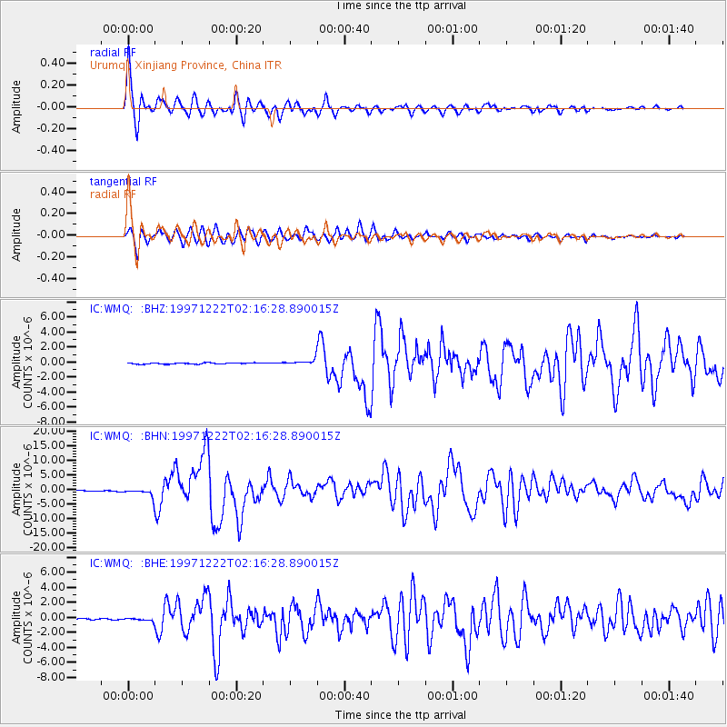
Signal To Noise
| Channel | StoN | STA | LTA |
| IC:WMQ: :BHN:19971222T02:16:28.890015Z | 16.002113 | 1.5688272E-6 | 9.803875E-8 |
| IC:WMQ: :BHE:19971222T02:16:28.890015Z | 3.2649584 | 2.2544016E-7 | 6.9048404E-8 |
| IC:WMQ: :BHZ:19971222T02:16:28.890015Z | 6.035102 | 4.5865184E-7 | 7.599736E-8 |
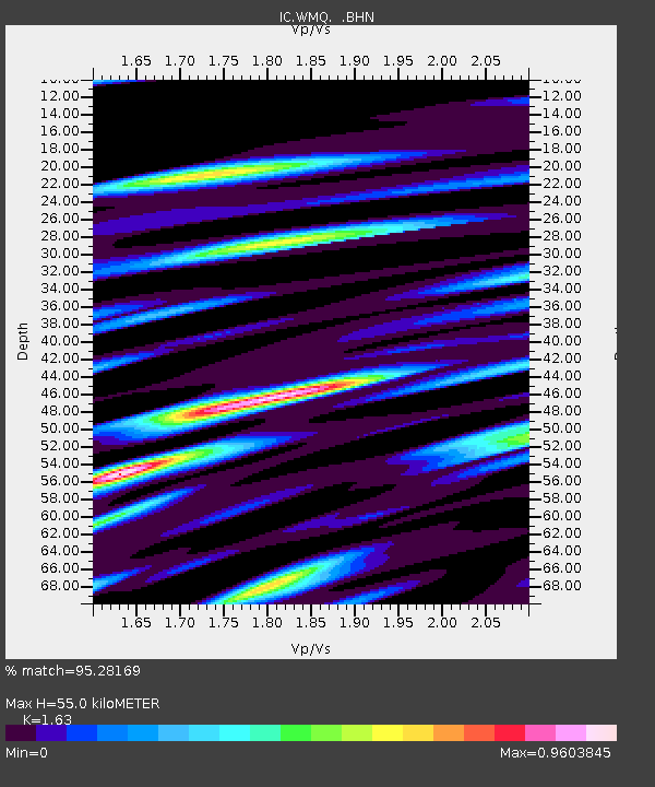
| Arrivals | |
| Ps | 5.7 SECOND |
| PpPs | 22 SECOND |
| PsPs/PpSs | 28 SECOND |

