You are here: Home > Network List > AK - Alaska Regional Network Stations List
> Station GAMB Gambell Broadband > Earthquake Result Viewer
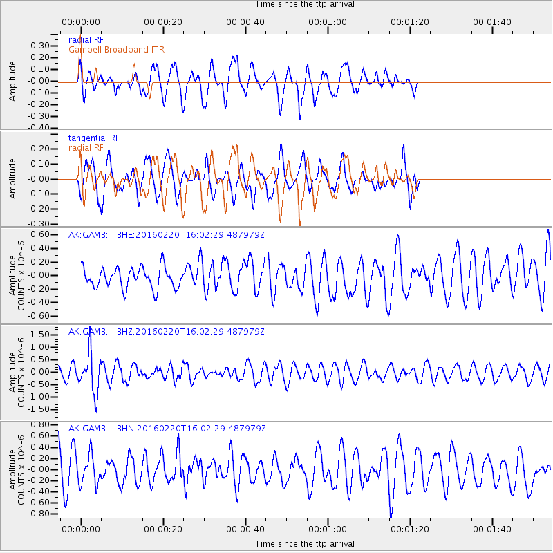
GAMB Gambell Broadband - Earthquake Result Viewer
*The percent match for this event was below the threshold and hence no stack was calculated.
| Earthquake location: |
Fiji Islands Region |
| Earthquake latitude/longitude: |
-21.9/-179.4 |
| Earthquake time(UTC): |
2016/02/20 (051) 15:51:22 GMT |
| Earthquake Depth: |
579 km |
| Earthquake Magnitude: |
5.8 MB |
| Earthquake Catalog/Contributor: |
NEIC PDE/NEIC COMCAT |
|
| Network: |
AK Alaska Regional Network |
| Station: |
GAMB Gambell Broadband |
| Lat/Lon: |
63.78 N/171.70 W |
| Elevation: |
10 m |
|
| Distance: |
85.6 deg |
| Az: |
3.404 deg |
| Baz: |
187.129 deg |
| Ray Param: |
$rayparam |
*The percent match for this event was below the threshold and hence was not used in the summary stack. |
|
| Radial Match: |
42.708786 % |
| Radial Bump: |
400 |
| Transverse Match: |
47.851288 % |
| Transverse Bump: |
400 |
| SOD ConfigId: |
7422571 |
| Insert Time: |
2019-04-21 22:54:23.624 +0000 |
| GWidth: |
2.5 |
| Max Bumps: |
400 |
| Tol: |
0.001 |
|
Signal To Noise
| Channel | StoN | STA | LTA |
| AK:GAMB: :BHZ:20160220T16:02:29.487979Z | 5.554221 | 7.763496E-7 | 1.3977652E-7 |
| AK:GAMB: :BHN:20160220T16:02:29.487979Z | 0.9163299 | 2.5619755E-7 | 2.7959095E-7 |
| AK:GAMB: :BHE:20160220T16:02:29.487979Z | 1.5071288 | 2.2586146E-7 | 1.4986207E-7 |
| Arrivals |
| Ps | |
| PpPs | |
| PsPs/PpSs | |


