WMQ Urumqi, Xinjiang Province, China - Earthquake Result Viewer
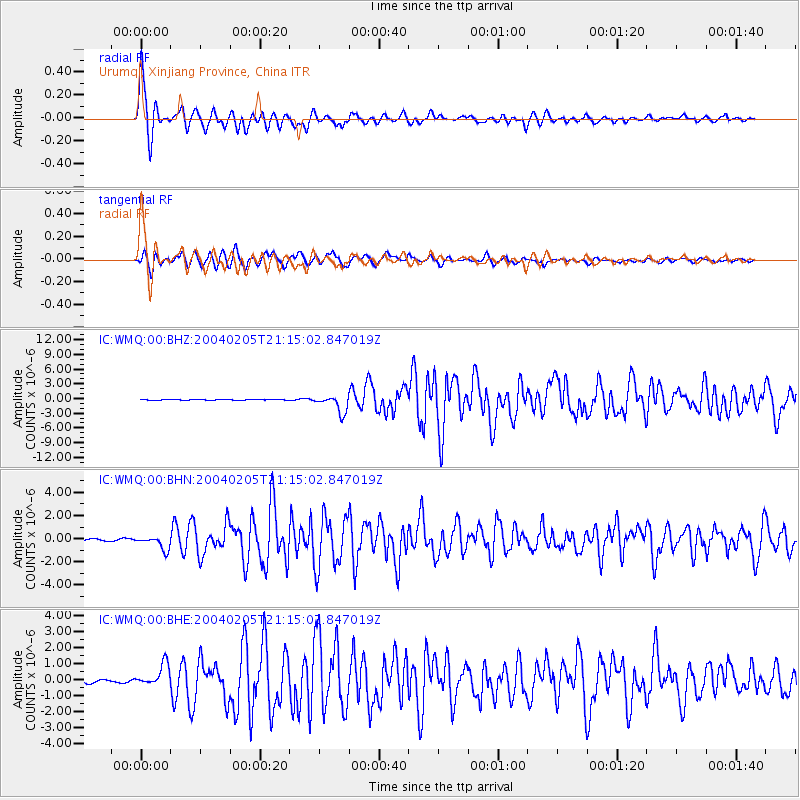
Earthquake location: Irian Jaya Region, Indonesia
Earthquake latitude/longitude: -3.6/135.5
Earthquake time(UTC): 2004/02/05 (036) 21:05:02 GMT
Earthquake Depth: 17 km
Earthquake Magnitude: 6.1 MB, 7.1 MS, 7.0 MW, 6.8 MW
Earthquake Catalog/Contributor: WHDF/NEIC
Network: IC New China Digital Seismograph Network
Station: WMQ Urumqi, Xinjiang Province, China
Lat/Lon: 43.82 N/87.69 E
Elevation: 903 m
Distance: 63.8 deg
Az: 323.269 deg
Baz: 124.449 deg
Ray Param: 0.05933204
Estimated Moho Depth: 21.0 km
Estimated Crust Vp/Vs: 1.68
Assumed Crust Vp: 6.242 km/s
Estimated Crust Vs: 3.727 km/s
Estimated Crust Poisson's Ratio: 0.22
Radial Match: 95.00873 %
Radial Bump: 400
Transverse Match: 87.07337 %
Transverse Bump: 400
SOD ConfigId: 2459
Insert Time: 2010-03-05 00:06:51.025 +0000
GWidth: 2.5
Max Bumps: 400
Tol: 0.001

Signal To Noise

ChannelStoNSTALTA
IC:WMQ:00:BHN:20040205T21:15:02.847019Z6.11197425.907053E-79.664722E-8
IC:WMQ:00:BHE:20040205T21:15:02.847019Z6.4770636.82061E-71.0530405E-7
IC:WMQ:00:BHZ:20040205T21:15:02.847019Z22.2564351.7797291E-67.99647E-8
Arrivals
Ps2.4 SECOND
PpPs8.6 SECOND
PsPs/PpSs11 SECOND