
WMQ Urumqi, Xinjiang Province, China - Earthquake Result Viewer
| ||||||||||||||||||
| ||||||||||||||||||
| ||||||||||||||||||
|
Signal To Noise
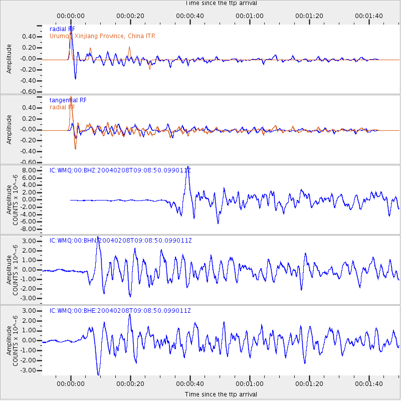
| Channel | StoN | STA | LTA |
| IC:WMQ:00:BHN:20040208T09:08:50.099011Z | 1.0452746 | 1.0146707E-7 | 9.707217E-8 |
| IC:WMQ:00:BHE:20040208T09:08:50.099011Z | 2.7014134 | 2.2682563E-7 | 8.396554E-8 |
| IC:WMQ:00:BHZ:20040208T09:08:50.099011Z | 7.9188385 | 6.5170065E-7 | 8.2297504E-8 |
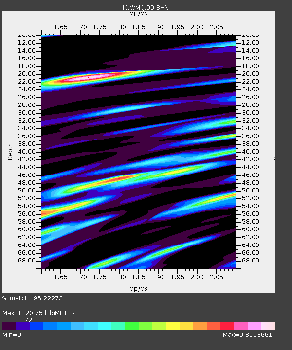
| Arrivals | |
| Ps | 2.5 SECOND |
| PpPs | 8.7 SECOND |
| PsPs/PpSs | 11 SECOND |

