You are here: Home > Network List > AK - Alaska Regional Network Stations List
> Station MDM Murphy Dome > Earthquake Result Viewer
MDM Murphy Dome - Earthquake Result Viewer
*The percent match for this event was below the threshold and hence no stack was calculated.
| Earthquake location: |
Fiji Islands Region |
| Earthquake latitude/longitude: |
-21.9/-179.4 |
| Earthquake time(UTC): |
2016/02/20 (051) 15:51:22 GMT |
| Earthquake Depth: |
579 km |
| Earthquake Magnitude: |
5.8 MB |
| Earthquake Catalog/Contributor: |
NEIC PDE/NEIC COMCAT |
|
| Network: |
AK Alaska Regional Network |
| Station: |
MDM Murphy Dome |
| Lat/Lon: |
64.96 N/148.23 W |
| Elevation: |
634 m |
|
| Distance: |
89.9 deg |
| Az: |
12.711 deg |
| Baz: |
208.69 deg |
| Ray Param: |
$rayparam |
*The percent match for this event was below the threshold and hence was not used in the summary stack. |
|
| Radial Match: |
52.992786 % |
| Radial Bump: |
387 |
| Transverse Match: |
55.161194 % |
| Transverse Bump: |
382 |
| SOD ConfigId: |
7422571 |
| Insert Time: |
2019-04-21 22:54:34.878 +0000 |
| GWidth: |
2.5 |
| Max Bumps: |
400 |
| Tol: |
0.001 |
|
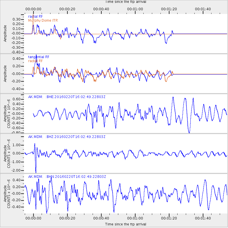
Signal To Noise
| Channel | StoN | STA | LTA |
| AK:MDM: :BHZ:20160220T16:02:49.22803Z | 3.8033357 | 6.982667E-7 | 1.8359324E-7 |
| AK:MDM: :BHN:20160220T16:02:49.22803Z | 1.0202395 | 2.1636774E-7 | 2.1207545E-7 |
| AK:MDM: :BHE:20160220T16:02:49.22803Z | 1.5685823 | 1.8848286E-7 | 1.2016129E-7 |
| Arrivals |
| Ps | |
| PpPs | |
| PsPs/PpSs | |


