You are here: Home > Network List > CI - Caltech Regional Seismic Network Stations List
> Station TUQ Turquiose Mountain, Baker, CA, USA > Earthquake Result Viewer
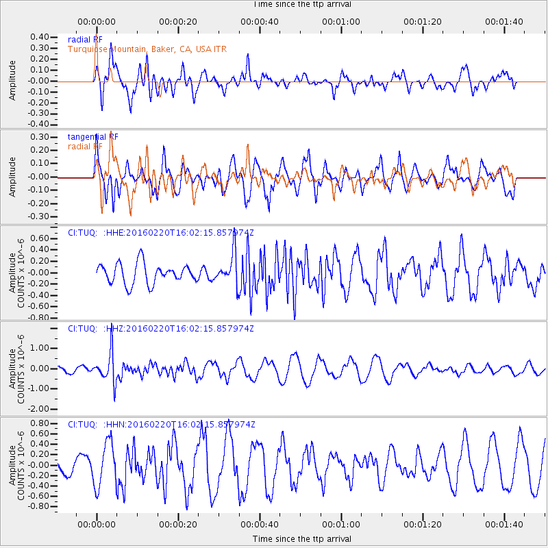
TUQ Turquiose Mountain, Baker, CA, USA - Earthquake Result Viewer
*The percent match for this event was below the threshold and hence no stack was calculated.
| Earthquake location: |
Fiji Islands Region |
| Earthquake latitude/longitude: |
-21.9/-179.4 |
| Earthquake time(UTC): |
2016/02/20 (051) 15:51:22 GMT |
| Earthquake Depth: |
579 km |
| Earthquake Magnitude: |
5.8 MB |
| Earthquake Catalog/Contributor: |
NEIC PDE/NEIC COMCAT |
|
| Network: |
CI Caltech Regional Seismic Network |
| Station: |
TUQ Turquiose Mountain, Baker, CA, USA |
| Lat/Lon: |
35.44 N/115.92 W |
| Elevation: |
1350 m |
|
| Distance: |
82.8 deg |
| Az: |
47.405 deg |
| Baz: |
236.839 deg |
| Ray Param: |
$rayparam |
*The percent match for this event was below the threshold and hence was not used in the summary stack. |
|
| Radial Match: |
71.55893 % |
| Radial Bump: |
400 |
| Transverse Match: |
72.90266 % |
| Transverse Bump: |
400 |
| SOD ConfigId: |
7422571 |
| Insert Time: |
2019-04-21 22:56:41.298 +0000 |
| GWidth: |
2.5 |
| Max Bumps: |
400 |
| Tol: |
0.001 |
|
Signal To Noise
| Channel | StoN | STA | LTA |
| CI:TUQ: :HHZ:20160220T16:02:15.857974Z | 2.8903966 | 7.598447E-7 | 2.6288595E-7 |
| CI:TUQ: :HHN:20160220T16:02:15.857974Z | 3.1262748 | 4.3810377E-7 | 1.4013604E-7 |
| CI:TUQ: :HHE:20160220T16:02:15.857974Z | 1.6345912 | 2.8839588E-7 | 1.7643302E-7 |
| Arrivals |
| Ps | |
| PpPs | |
| PsPs/PpSs | |


