You are here: Home > Network List > TA - USArray Transportable Network (new EarthScope stations) Stations List
> Station A21K Barrow, AK, USA > Earthquake Result Viewer
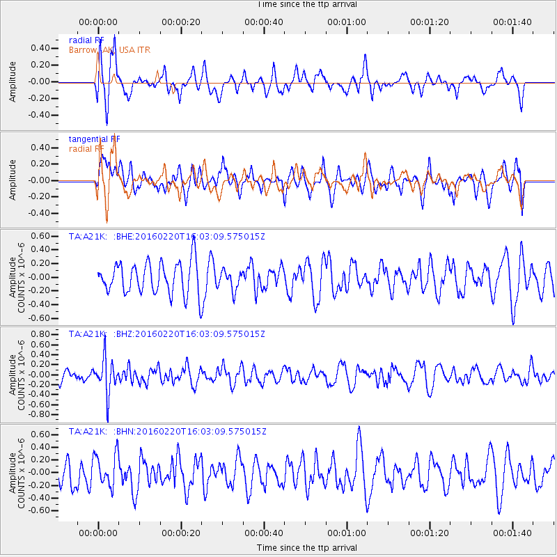
A21K Barrow, AK, USA - Earthquake Result Viewer
*The percent match for this event was below the threshold and hence no stack was calculated.
| Earthquake location: |
Fiji Islands Region |
| Earthquake latitude/longitude: |
-21.9/-179.4 |
| Earthquake time(UTC): |
2016/02/20 (051) 15:51:22 GMT |
| Earthquake Depth: |
579 km |
| Earthquake Magnitude: |
5.8 MB |
| Earthquake Catalog/Contributor: |
NEIC PDE/NEIC COMCAT |
|
| Network: |
TA USArray Transportable Network (new EarthScope stations) |
| Station: |
A21K Barrow, AK, USA |
| Lat/Lon: |
71.32 N/156.62 W |
| Elevation: |
577 m |
|
| Distance: |
94.3 deg |
| Az: |
7.175 deg |
| Baz: |
201.1 deg |
| Ray Param: |
$rayparam |
*The percent match for this event was below the threshold and hence was not used in the summary stack. |
|
| Radial Match: |
54.688694 % |
| Radial Bump: |
400 |
| Transverse Match: |
56.838448 % |
| Transverse Bump: |
400 |
| SOD ConfigId: |
7422571 |
| Insert Time: |
2019-04-21 22:58:49.590 +0000 |
| GWidth: |
2.5 |
| Max Bumps: |
400 |
| Tol: |
0.001 |
|
Signal To Noise
| Channel | StoN | STA | LTA |
| TA:A21K: :BHZ:20160220T16:03:09.575015Z | 2.0234835 | 3.5731634E-7 | 1.7658475E-7 |
| TA:A21K: :BHN:20160220T16:03:09.575015Z | 1.5600969 | 2.6408523E-7 | 1.692749E-7 |
| TA:A21K: :BHE:20160220T16:03:09.575015Z | 0.6226025 | 1.4351036E-7 | 2.3050077E-7 |
| Arrivals |
| Ps | |
| PpPs | |
| PsPs/PpSs | |


