You are here: Home > Network List > TA - USArray Transportable Network (new EarthScope stations) Stations List
> Station J04D Umpqua National Forest, Toketee, OR, USA > Earthquake Result Viewer
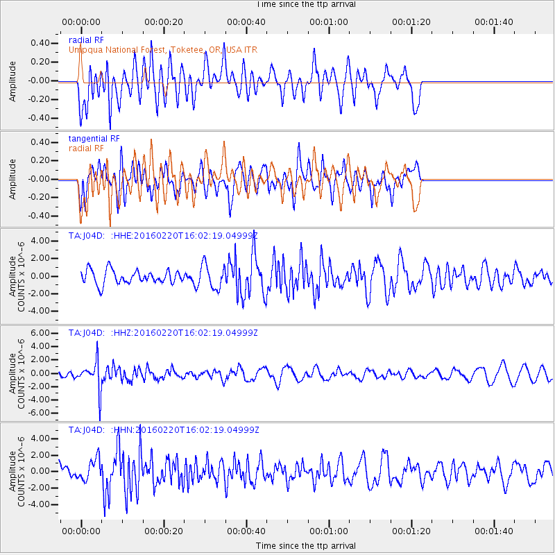
J04D Umpqua National Forest, Toketee, OR, USA - Earthquake Result Viewer
*The percent match for this event was below the threshold and hence no stack was calculated.
| Earthquake location: |
Fiji Islands Region |
| Earthquake latitude/longitude: |
-21.9/-179.4 |
| Earthquake time(UTC): |
2016/02/20 (051) 15:51:22 GMT |
| Earthquake Depth: |
579 km |
| Earthquake Magnitude: |
5.8 MB |
| Earthquake Catalog/Contributor: |
NEIC PDE/NEIC COMCAT |
|
| Network: |
TA USArray Transportable Network (new EarthScope stations) |
| Station: |
J04D Umpqua National Forest, Toketee, OR, USA |
| Lat/Lon: |
43.24 N/122.11 W |
| Elevation: |
1948 m |
|
| Distance: |
83.5 deg |
| Az: |
38.216 deg |
| Baz: |
231.823 deg |
| Ray Param: |
$rayparam |
*The percent match for this event was below the threshold and hence was not used in the summary stack. |
|
| Radial Match: |
57.19456 % |
| Radial Bump: |
400 |
| Transverse Match: |
52.57354 % |
| Transverse Bump: |
400 |
| SOD ConfigId: |
7422571 |
| Insert Time: |
2019-04-21 22:58:58.701 +0000 |
| GWidth: |
2.5 |
| Max Bumps: |
400 |
| Tol: |
0.001 |
|
Signal To Noise
| Channel | StoN | STA | LTA |
| TA:J04D: :HHZ:20160220T16:02:19.04999Z | 5.705767 | 2.1857081E-6 | 3.8306996E-7 |
| TA:J04D: :HHN:20160220T16:02:19.04999Z | 0.8332448 | 1.3356238E-6 | 1.6029188E-6 |
| TA:J04D: :HHE:20160220T16:02:19.04999Z | 1.8366218 | 1.4154404E-6 | 7.706761E-7 |
| Arrivals |
| Ps | |
| PpPs | |
| PsPs/PpSs | |


