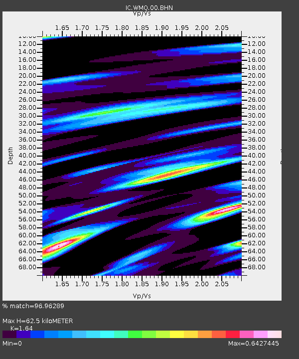
WMQ Urumqi, Xinjiang Province, China - Earthquake Result Viewer
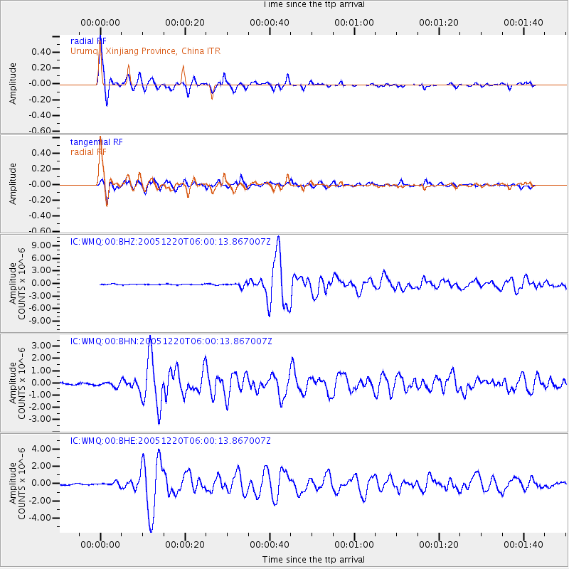
Earthquake location: W. Caroline Islands, Micronesia
Earthquake latitude/longitude: 12.2/141.0
Earthquake time(UTC): 2005/12/20 (354) 05:51:12 GMT
Earthquake Depth: 23 km
Earthquake Magnitude: 5.8 MB, 5.7 MS, 6.1 MW, 6.1 MW
Earthquake Catalog/Contributor: WHDF/NEIC
Network: IC New China Digital Seismograph Network
Station: WMQ Urumqi, Xinjiang Province, China
Lat/Lon: 43.82 N/87.69 E
Elevation: 903 m
Distance: 55.4 deg
Az: 315.153 deg
Baz: 107.739 deg
Ray Param: 0.06479958
Estimated Moho Depth: 62.5 km
Estimated Crust Vp/Vs: 1.64
Assumed Crust Vp: 6.242 km/s
Estimated Crust Vs: 3.806 km/s
Estimated Crust Poisson's Ratio: 0.20
Radial Match: 96.96289 %
Radial Bump: 356
Transverse Match: 93.37086 %
Transverse Bump: 400
SOD ConfigId: 2564
Insert Time: 2010-03-05 00:08:24.518 +0000
GWidth: 2.5
Max Bumps: 400
Tol: 0.001

Signal To Noise

ChannelStoNSTALTA
IC:WMQ:00:BHN:20051220T06:00:13.867007Z1.81914411.912674E-71.05141424E-7
IC:WMQ:00:BHE:20051220T06:00:13.867007Z1.74629262.136926E-71.223693E-7
IC:WMQ:00:BHZ:20051220T06:00:13.867007Z4.68833884.635306E-79.886884E-8
Arrivals
Ps6.8 SECOND
PpPs25 SECOND
PsPs/PpSs32 SECOND