You are here: Home > Network List > UW - Pacific Northwest Regional Seismic Network Stations List
> Station WOLL Wollman Farm, Schrag, WA, USA > Earthquake Result Viewer
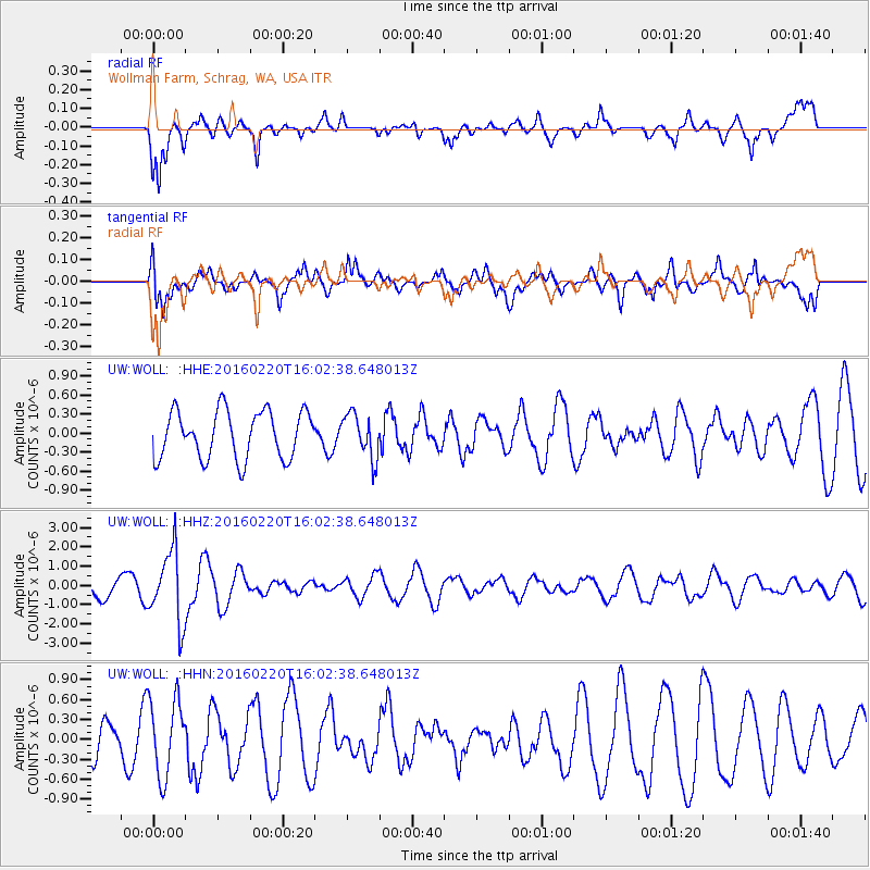
WOLL Wollman Farm, Schrag, WA, USA - Earthquake Result Viewer
*The percent match for this event was below the threshold and hence no stack was calculated.
| Earthquake location: |
Fiji Islands Region |
| Earthquake latitude/longitude: |
-21.9/-179.4 |
| Earthquake time(UTC): |
2016/02/20 (051) 15:51:22 GMT |
| Earthquake Depth: |
579 km |
| Earthquake Magnitude: |
5.8 MB |
| Earthquake Catalog/Contributor: |
NEIC PDE/NEIC COMCAT |
|
| Network: |
UW Pacific Northwest Regional Seismic Network |
| Station: |
WOLL Wollman Farm, Schrag, WA, USA |
| Lat/Lon: |
47.06 N/118.92 W |
| Elevation: |
385 m |
|
| Distance: |
87.6 deg |
| Az: |
36.53 deg |
| Baz: |
233.945 deg |
| Ray Param: |
$rayparam |
*The percent match for this event was below the threshold and hence was not used in the summary stack. |
|
| Radial Match: |
57.10285 % |
| Radial Bump: |
400 |
| Transverse Match: |
73.419395 % |
| Transverse Bump: |
400 |
| SOD ConfigId: |
7422571 |
| Insert Time: |
2019-04-21 22:59:52.838 +0000 |
| GWidth: |
2.5 |
| Max Bumps: |
400 |
| Tol: |
0.001 |
|
Signal To Noise
| Channel | StoN | STA | LTA |
| UW:WOLL: :HHZ:20160220T16:02:38.648013Z | 3.2642334 | 1.861622E-6 | 5.703091E-7 |
| UW:WOLL: :HHN:20160220T16:02:38.648013Z | 2.2008038 | 5.7908227E-7 | 2.631231E-7 |
| UW:WOLL: :HHE:20160220T16:02:38.648013Z | 0.9137136 | 3.4378533E-7 | 3.7625065E-7 |
| Arrivals |
| Ps | |
| PpPs | |
| PsPs/PpSs | |


