WMQ Urumqi, Xinjiang Province, China - Earthquake Result Viewer
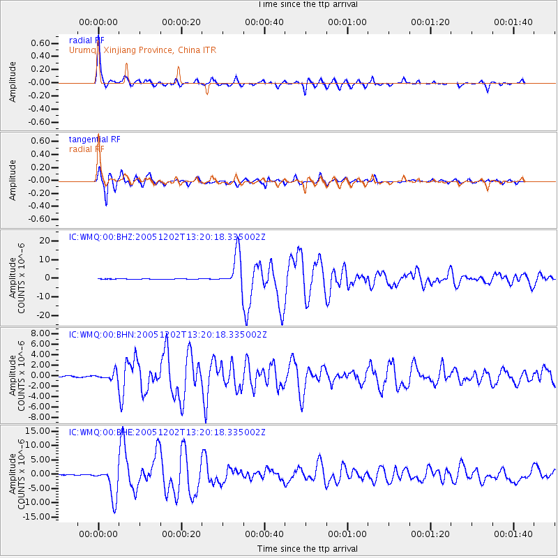
Earthquake location: Near East Coast Of Honshu, Japan
Earthquake latitude/longitude: 38.1/142.1
Earthquake time(UTC): 2005/12/02 (336) 13:13:09 GMT
Earthquake Depth: 29 km
Earthquake Magnitude: 6.1 MB, 6.3 MS, 6.5 MW, 6.4 MW
Earthquake Catalog/Contributor: WHDF/NEIC
Network: IC New China Digital Seismograph Network
Station: WMQ Urumqi, Xinjiang Province, China
Lat/Lon: 43.82 N/87.69 E
Elevation: 903 m
Distance: 40.9 deg
Az: 295.891 deg
Baz: 78.726 deg
Ray Param: 0.074087285
Estimated Moho Depth: 42.25 km
Estimated Crust Vp/Vs: 1.96
Assumed Crust Vp: 6.242 km/s
Estimated Crust Vs: 3.189 km/s
Estimated Crust Poisson's Ratio: 0.32
Radial Match: 95.28812 %
Radial Bump: 310
Transverse Match: 95.88635 %
Transverse Bump: 400
SOD ConfigId: 2564
Insert Time: 2010-03-05 00:08:33.706 +0000
GWidth: 2.5
Max Bumps: 400
Tol: 0.001

Signal To Noise

ChannelStoNSTALTA
IC:WMQ:00:BHN:20051202T13:20:18.335002Z4.65523438.1759447E-71.7562907E-7
IC:WMQ:00:BHE:20051202T13:20:18.335002Z63.5182345.6439717E-68.8855934E-8
IC:WMQ:00:BHZ:20051202T13:20:18.335002Z88.224119.669172E-61.0959783E-7
Arrivals
Ps6.9 SECOND
PpPs19 SECOND
PsPs/PpSs26 SECOND