
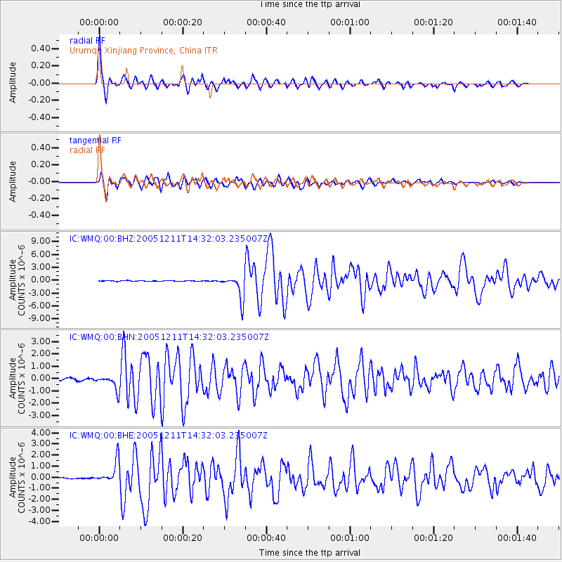
WMQ Urumqi, Xinjiang Province, China - Earthquake Result Viewer
| ||||||||||||||||||
| ||||||||||||||||||
| ||||||||||||||||||
|
Signal To Noise
| Channel | StoN | STA | LTA |
| IC:WMQ:00:BHN:20051211T14:32:03.235007Z | 8.268038 | 6.301037E-7 | 7.620958E-8 |
| IC:WMQ:00:BHE:20051211T14:32:03.235007Z | 11.33665 | 1.0673608E-6 | 9.4151346E-8 |
| IC:WMQ:00:BHZ:20051211T14:32:03.235007Z | 46.650402 | 2.9169578E-6 | 6.252803E-8 |
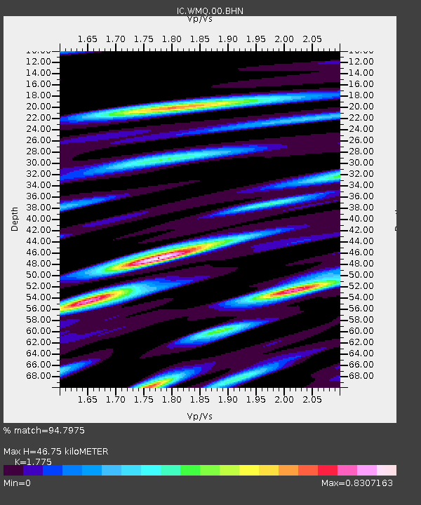
| Arrivals | |
| Ps | 6.0 SECOND |
| PpPs | 20 SECOND |
| PsPs/PpSs | 26 SECOND |

