You are here: Home > Network List > AV - Alaska Volcano Observatory Stations List
> Station SPCR Ckakachatna River, Mount Spurr, Alaska > Earthquake Result Viewer
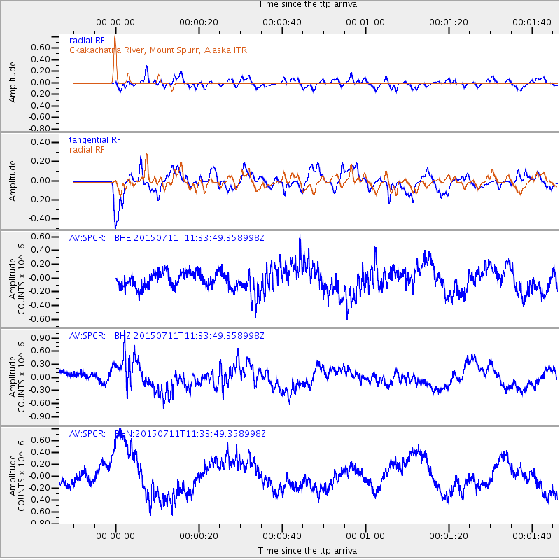
SPCR Ckakachatna River, Mount Spurr, Alaska - Earthquake Result Viewer
*The percent match for this event was below the threshold and hence no stack was calculated.
| Earthquake location: |
East Of Kuril Islands |
| Earthquake latitude/longitude: |
43.9/148.0 |
| Earthquake time(UTC): |
2015/07/11 (192) 11:26:59 GMT |
| Earthquake Depth: |
32 km |
| Earthquake Magnitude: |
5.5 MB |
| Earthquake Catalog/Contributor: |
NEIC PDE/NEIC COMCAT |
|
| Network: |
AV Alaska Volcano Observatory |
| Station: |
SPCR Ckakachatna River, Mount Spurr, Alaska |
| Lat/Lon: |
61.20 N/152.21 W |
| Elevation: |
984 m |
|
| Distance: |
38.7 deg |
| Az: |
42.041 deg |
| Baz: |
271.48 deg |
| Ray Param: |
$rayparam |
*The percent match for this event was below the threshold and hence was not used in the summary stack. |
|
| Radial Match: |
53.205044 % |
| Radial Bump: |
400 |
| Transverse Match: |
59.046936 % |
| Transverse Bump: |
400 |
| SOD ConfigId: |
1085051 |
| Insert Time: |
2015-07-25 11:47:08.094 +0000 |
| GWidth: |
2.5 |
| Max Bumps: |
400 |
| Tol: |
0.001 |
|
Signal To Noise
| Channel | StoN | STA | LTA |
| AV:SPCR: :BHZ:20150711T11:33:49.358998Z | 3.4863486 | 4.527492E-7 | 1.2986342E-7 |
| AV:SPCR: :BHN:20150711T11:33:49.358998Z | 6.1126156 | 6.6672095E-7 | 1.09072936E-7 |
| AV:SPCR: :BHE:20150711T11:33:49.358998Z | 1.9165423 | 2.019549E-7 | 1.0537462E-7 |
| Arrivals |
| Ps | |
| PpPs | |
| PsPs/PpSs | |


